


Case Study Industries: Geospatial
27 June 2022
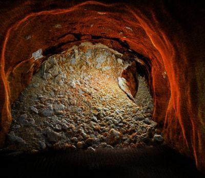
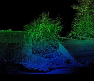
Pinpointing a Blockage in an Inaccessible Hydro Station Tunnel
When a station in Hyltebruk in southwest Sweden was alerted to a surface level sinkhole above a water tunnel, they needed to locate and investigate the rockfall and probable deterioration of the tunnel’s concrete lining.
27 June 2022
Pinpointing a Blockage in an Inaccessible Hydro Station Tunnel
When a station in Hyltebruk in southwest Sweden was alerted to a surface level sinkhole above a water tunnel, they needed to locate and investigate the rockfall and probable deterioration of the tunnel’s concrete lining.
27 May 2022
Osprey Integrity Speeds up Natural Disaster Recovery with Fast, Accurate Data Capture
After a natural disaster, repairing critical infrastructure can take years, making it difficult to return to life as usual.

6 April 2022
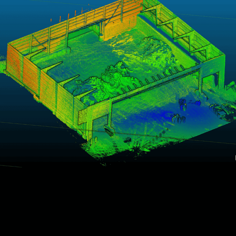
GeoZICHT Achieves Entire Traffic Bridge Inspection
GeoZICHT sought a tool to enhance the collection of complete visual inspection data for bridge inspections while also increasing the overall safety of the underlying process.

11 January 2022
Brierley Associates Speeds up road tunnel inspection
Brierley Associates sought a solution to tunnel inspection that would reduce the disruption to traffic while keeping the inspection team safe.

22 December 2021
UDM Group Improves Efficiency and Safety for Topographic Surveys
Hovermap helps UDM Group reduce time-on-site for a bridge survey and flood study.
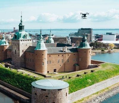
17 December 2021
Kalmar Municipality streamlines digital capture for community planning
Kalmar Municipality captured a heritage landmark completely and quickly – a great start to their digital capture of the municipality.
6 December 2021
Walden Environmental Engineering Captures New Insights and Revenue
Walden Environmental Engineering have realized new revenue opportunities

10 August 2020
20+ Ways to Use Hovermap
Discover 20+ of Hovermap’s many data capture applications across a wide range of industries.
30 June 2020
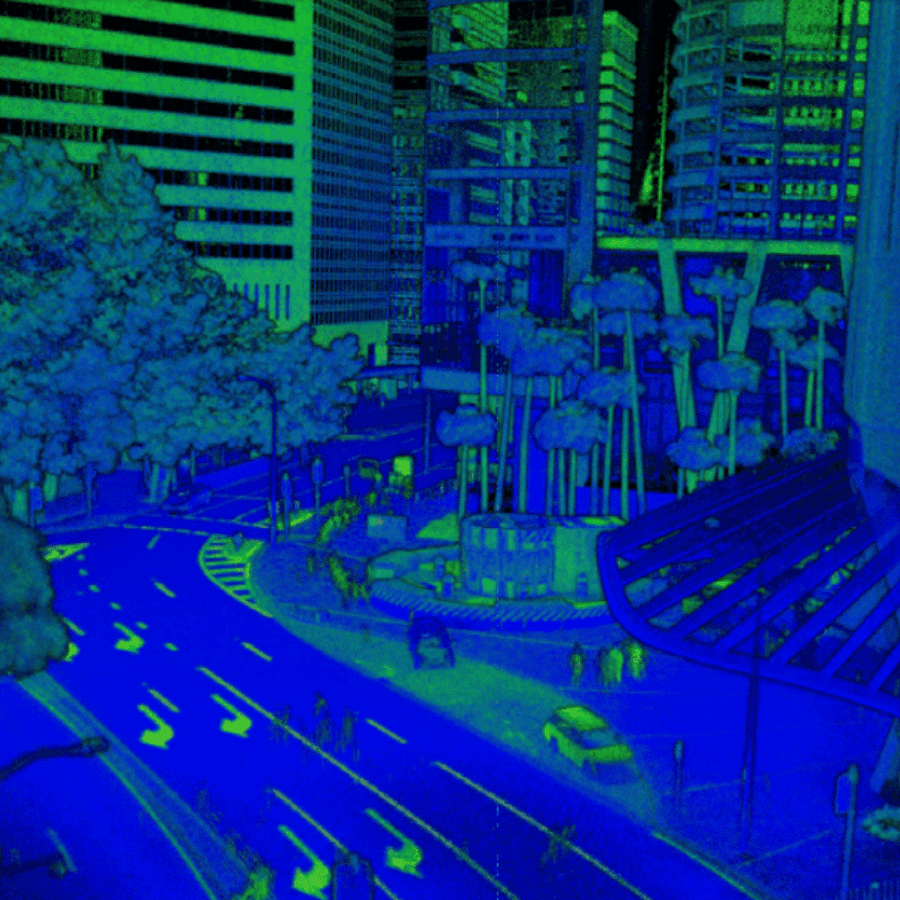
Hovermap Accuracy
Lightweight, easy to use and deploy, the versatile Emesent Hovermap mobile LiDAR scanner is changing the way that people think about the collection of high-resolution 3D data.
18 June 2020
Hovermap helps XM2 PURSUIT bring blockbusters to the silver screen
XM2 PURSUIT are experts in aerial cinematography for the film and television and commercial industries.