A press panel reviewed the pitches of 18 exhibitors at the event, searching for the three most unique and innovative new solutions showcased at Geo Week
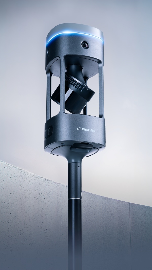
 DENVER, 18 February 2026 ― Today at Geo Week, Emesent, a global leader in autonomous mapping technology, is pleased to share that it has been selected as a winner of the Geo Week Pitch the Press competition for its newly launched Emesent GX1, the world's most accurate integrated Simultaneous Localization and Mapping (SLAM) and Real-Time Kinematic (RTK) scanner.
Back in 2024, Emesent also won the same competition for Emesent Hovermap, a smart mobile scanning unit that combines advanced collision avoidance and autonomous flight technologies to map hazardous and GPS-denied environments.
The Pitch the Press competition is an hour-long event in which the press panel analyzes two-minute pitches of each selected exhibitor, followed by a minute-long Q&A session. After the pitches, the panel of four judges was tasked with selecting three winners, representing the most innovative and unique solutions showcased at Geo Week 2026.
The GX1 was selected among the three winners following its launch at the event on Monday, February 16, 2026. The product represents a major industry milestone, delivering 5–10mm global accuracy and setting a new standard for precision in topographic surveying and building and infrastructure construction. It can also cut site survey time by up to 95%, transforming tasks that once took weeks into just a single day of scanning.
"Following our previous win in 2024 for Hovermap and now in 2026 for Emesent GX1, it is a great honor to be recognized for building innovative systems that advance the reality capture and surveying industries,” said Dr. Stefan Hrabar, Chief Strategy Officer and Co-Founder of Emesent.
“Emesent continues to push the boundaries of what is possible in SLAM-based mobile mapping, and this award goes a long way to recognize our determination to put the best technology in the hands of surveyors – at all levels of skill and experience."