
How UAS Deployed Hovermap STX to Map a 22-Acre Mine Collapse - Autonomously
About the Client
Unmanned Aerial Services Inc (UAS Inc) is an Inspection Service Provider for Indoor Industrial and Underground Mine locations. UAS Inc utilizes Emesent Hovermap to inspect dangerous / difficult areas of operations, removing traditional human methodology and adding an increased safety factor while providing detailed visual and laser scan information for their clients.
The Challenge: A Catastrophic Fall of Ground
When the call came in from a limestone quarry in Iowa, USA, the situation was dire. A massive fall of ground had occurred underground, affecting approximately 22 acres of active mining area - roughly a quarter of the entire operation. Large sections of the mine were blocked off and destabilized, with rockfalls continuing to echo through the drifts. The mine operator faced an impossible choice: how do you assess the damage without putting anyone at risk?
The Challenge with Traditional Processes
Traditional assessment methods involving human entry were simply not an option. The environment was too unstable, too dangerous, and too uncertain. Yet without understanding the extent of the collapse, the mine couldn't plan its response or determine when - or if - operations could safely resume.
Emesent Solution
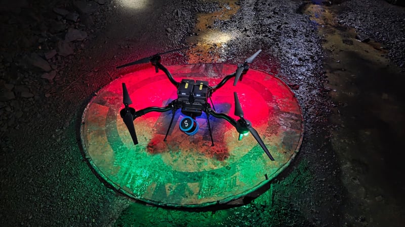
That's when Unmanned Aerial Services (UAS) deployed Emesent's Hovermap autonomous drone technology. Their mission: map over 5 kilometers of underground workings in GPS-denied conditions, navigate around an active collapse zone, and deliver actionable intelligence—all within 48 hours of the initial emergency call.
The Mission: Autonomous Navigation Where Humans Couldn't Go
The challenge was more than just distance. The environment presented every obstacle imaginable for underground operations:
- Complete GPS signal denial throughout the mine workings
- Extended operational distances requiring flights of up to 1.3 kilometers one-way
- Tight access points around the fall of ground with as little as 6-8 inches of clearance around the propellers
- Significant flooding with water depths exceeding 40 feet in benched areas
- Communication constraints at extended ranges, with signal dropping intermittently beyond 100-800 meters
- Continuing instability, with rockfalls occurring during flight operations
In these conditions, Hovermap's autonomous navigation capabilities became mission-critical. The system operated entirely without GPS, relying instead on real-time 3D LiDAR-based simultaneous localization and mapping (SLAM). The drone navigated tight intersections, avoided hanging rocks, and carefully skirted flooded sections—all while maintaining its position safely and plotting its return path.
"As someone who's been flying this system for nearly eight years, it still impresses me," said Matt Mackinnon, founder and president of UAS. "The drone gets itself into places that I, as a human pilot, would never fly it into. But the autonomous system has that 360-degree perception and can navigate obstacles I can't even see."
During the most critical flight, the drone was sent on what the team called a "full send" mission - plotting waypoints beyond communication range and awaiting its return. For 20 minutes, they had no contact. The drone was on its own, navigating over a kilometer into unstable workings, making real-time decisions about obstacles and pathways.
It returned successfully, carrying comprehensive 3D scan data of the entire collapse zone.
Product Overview
Emesent helps businesses map the unknown, minimizing operational downtime while improving worker safety.
Hovermap STX
Fast, accurate, high-detail mobile data capture
Featuring AI-powered autonomous mapping, Hovermap incorporates the latest in LiDAR sensing technology to generate high-density point clouds with exceptional coverage. With a sensing range of up to 300 meters and the ability to capture more than a million points per second, Hovermap delivers detailed, survey-grade data over a wide area fast – accelerating your time to insight.
Deployment options to suit your needs
Hovermap’s unique versatility allows users to capture data from previously inaccessible areas, either from the air or on the ground. The plug-and-play design enables easy switching from drone-based use to handheld, backpack, vehicle or ground robot-mounted scanning.
DJI M350 drone, AstroMax
Fast, accurate, drone-based scans without GCPs
Emesent Aura now supports RTK, automating high-accuracy georeferencing and drift correction for Hovermap scans on DJI’s M300 and M350 drones. This enables the delivery of fast, accurate and precise above-ground drone scans on demand, without the need to lay out and georeference ground control points.
Simply attach the Hovermap to your DJI M300 or M350 drone with the purpose-built mount, establish a connection, and you are ready to start scanning. During processing Aura automatically evaluates the GPS signal quality and will intelligently choose the optimal combination of RTK and SLAM (either RTK and SLAM, or SLAM only if RTK is not of high enough quality), toggling between the two, to provide the user with the most reliable and robust point cloud.
The Results: Eyes Underground in Record Time
.jpg?width=800&height=517&name=UAS%20Case%20Study%202025-10-24_(1).jpg) Within 48 hours of the initial emergency call, UAS and Hovermap had completed multiple autonomous flights covering over 5 kilometers of underground workings. The comprehensive 3D point cloud data - captured at nearly 2 million points per second - revealed:
Within 48 hours of the initial emergency call, UAS and Hovermap had completed multiple autonomous flights covering over 5 kilometers of underground workings. The comprehensive 3D point cloud data - captured at nearly 2 million points per second - revealed:
- The full extent of the 22-acre collapse
- The condition of the surrounding drifts and pillars
- Signs of water impoundment that likely contributed to the instability
- Safe access routes for future operations
- Areas requiring immediate ground support
Critically, the team paired LiDAR scanning with 360-degree camera footage, providing both precise spatial data and immediate visual context. While scan processing took time, the video gave stakeholders instant feedback on conditions underground - all without a single person entering the hazard zone.
"Without doubt, the ability of Hovermap to enter areas that are completely inaccessible, capture data, and return to safety autonomously opens up new opportunities for mine incident analysis and response," Mackinnon noted.
The Hidden Value: Change Detection and Prevention
What made this mission even more valuable was a discovery made during the operation. The mine operator had commissioned scans of the workings the previous year as part of their acquisition due diligence. By overlaying the new emergency scans with this historical data, the team could see exactly what had changed.
The comparison was revealing and sobering. When the historical scans were reviewed alongside the new data, they highlighted patterns consistent with progressive ground degradation, including hourglassing pillars, deformation extending from the earlier 2019 fall of ground, and areas where gradual change was not readily apparent at the time. Surface LiDAR revealed that water from a farmer's field had been channeling into the old collapse zone for an extended period, concentrating flow and contributing to weakening of the surrounding limestone. With up to 22 feet of surface subsidence documented above the collapse area, the integrated datasets provided a clearer understanding of the factors that contributed to the failure.
"The big takeaway is this: scan as much as you can, because you can always store the data," Mackinnon emphasized. "You don't have to process it immediately, but when something goes wrong, having that baseline is a game-changer. In this case, we were able to go back and see signs of instability that were there all along."
Lessons for Mine Safety: Proactive vs. Reactive
This case demonstrates both the emergency response capabilities of autonomous drone technology and its even greater value in routine, proactive monitoring:
For Emergency Response:
- Rapid deployment into inaccessible areas without risking personnel
- Autonomous navigation in GPS-denied, unstable conditions
- Real-time visual feedback combined with high-accuracy spatial data
- Extended operational reach beyond what ground-based methods can achieve
For Routine Operations:
- Establish baseline conditions through regular autonomous scanning
- Enable change detection monitoring to identify developing hazards
- Document areas where access constraints prevent ground-based surveying
- Support geotechnical analysis without exposing teams to risk
The mine has since invested in its own Hovermap system and implemented a regular scanning schedule - starting weekly, then monthly, then quarterly as confidence in ground conditions improves. They understand now that the technology isn't just for emergencies. It's for prevention.
The Bottom Line
When mines face catastrophic failures, minutes matter. But the real value of autonomous 3D mapping technology lies in the minutes, hours, and days before disaster strikes - when data can still prevent tragedy rather than just document it.
As this case demonstrates, autonomous drone technology doesn't just keep people safe during emergencies. It keeps them safe by helping prevent emergencies in the first place.
For more information about Hovermap autonomous mapping solutions for underground mining applications, contact Emesent or visit https://emesent.com/industry/mining/