Add true to life realism with multi-platform 360° colorization
Add a new level of reality capture to your 3D point clouds with Emesent’s 360° colorization. No matter if data is captured by drone, vehicle, backpack or handheld, it’s faster and easier than ever to augment Hovermap’s 3D point clouds with true 360° color to provide richer context and uncover deeper insights.
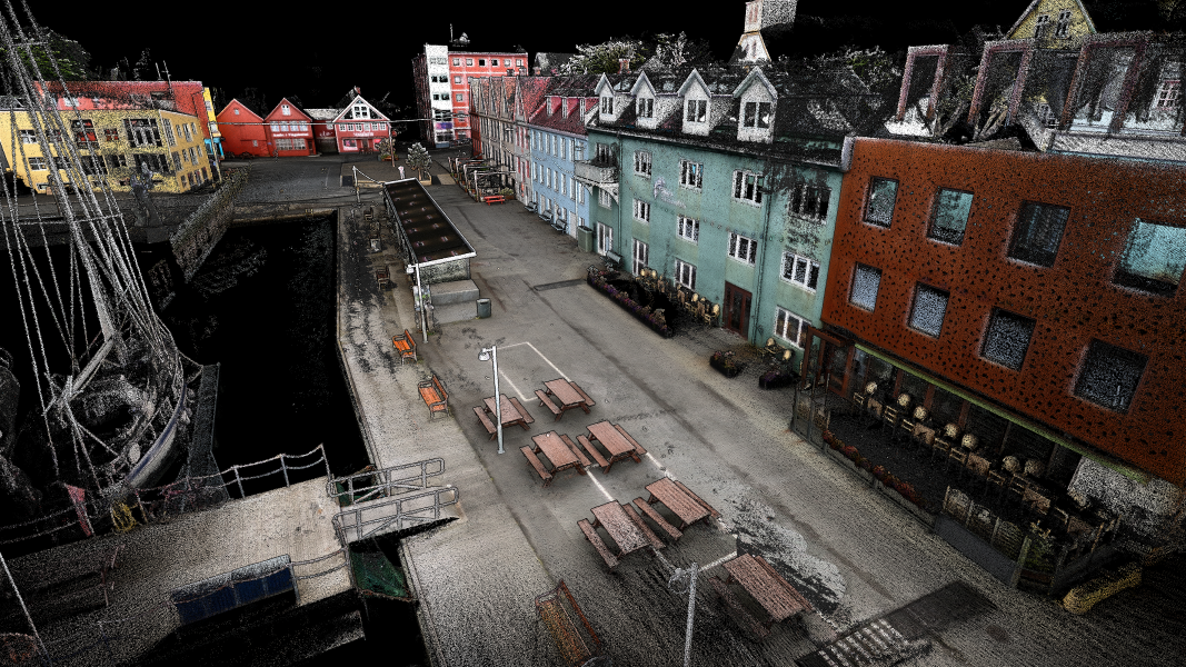
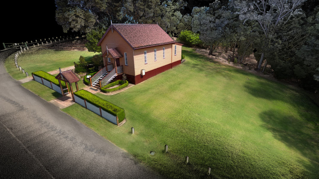
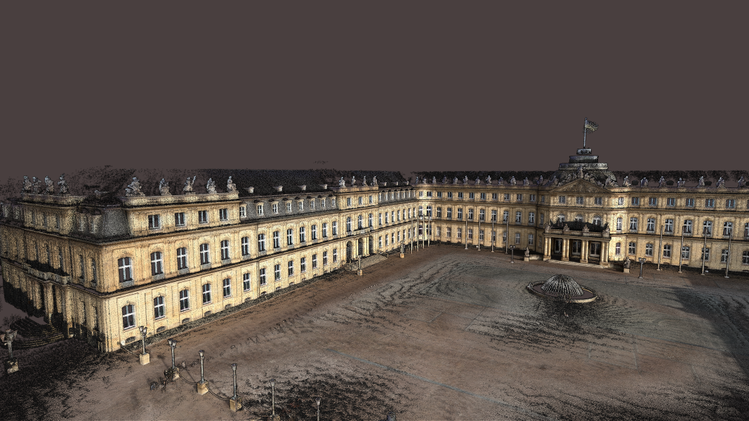
Reveal previously hidden details in your critical infrastructure, even in areas that may not be readily accessible or without GPS access. To colorize your scan, simply attach the rugged 360° action camera to Hovermap with our custom quick-release mount. The same scan can be used to extract 360° images, streamlining your workflow.
Processing efficiencies eliminate memory constraints, enabling colorizing of larger point clouds on lower spec machines.
Benefit from:
360° color and image capture with a single scan
One video capture can be used for both colorization and 360 images, streamlining workflows. Simply apply colorization and extract 360 images to highlight areas of interest or specific details.
Improve the quality of your outputs
Mask unwanted objects and review and remove unnecessary frames to achieve cleaner outputs and higher quality colorization.
Flexibility on the go
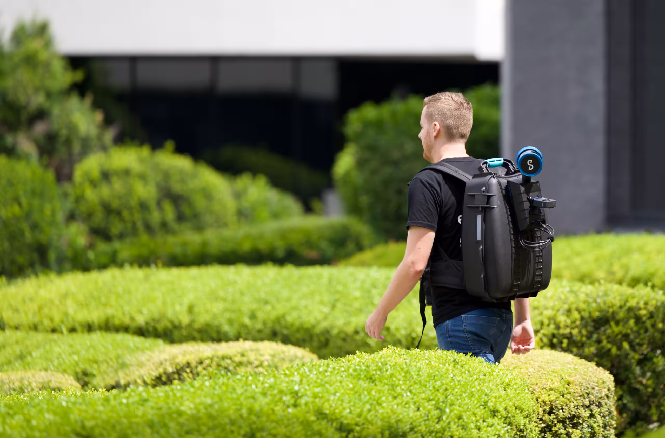
Attach the GoPro Hero Max 360 rugged action camera to Hovermap using our custom quick-release mount, giving you the flexibility to capture colorized scans as needed.
A modular approach
A powerful algorithm ensures precise calibration and synchronization of the camera and LiDAR sensor, combining ease of use with impressive results.
Accelerated capture
Simply hit record to gather colorized point clouds. Mount a camera-equipped Hovermap on a drone for hard-to-reach areas, a vehicle for road mapping, a backpack for walking scans, or use it handheld. Leverage advanced SLAM and flight autonomy for GPS-denied environments to push your colorization even further.
Ideal for large area multi-platform scanning
Effortlessly colorize merged datasets from an entire project site or asset, even if captured via different platforms.
Easy processing and visualization in Aura
Scanning, processing and visualization is effortless: start with the push of a button and process and visualize the LiDAR and video data via a simple workflow with a range of options to customize outputs.
Integrate with your existing workflows
Colorized point clouds, along with image frames and image pose data, can be visualized in Aura or imported into your favorite third-party software. Filtering is a breeze with per-point attributes such as range, intensity, return number, and time.
Where to use 360° Colorization for Hovermap
Aid understanding of non-expert stakeholders
Provide greater meaning to draftspeople working on a scan who do not have the original context
Communicate construction progress in AEC
Show greater detail to plan plant shutdowns in oil and gas
Add 360° images to colorization to allow deeper inspection of pipe or equipment condition
“From a geotechnical perspective, Hovermap captures the detail that we really need at a level of accuracy we weren’t able to get previously.
It never ceases to amaze me just how much it ‘sees’. The range and point density are incredible, the SLAM system is very accurate, providing us with quality data to make more informed assessments.”