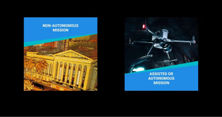
Product

Emesent Commander

    Watch the Commander Overview

    Photo: Varius pharetra congue pharetra lacus. Mus lectus sed at lectus pharetra. Adipiscing nisi nullam sed.

    Photo: Varius pharetra congue pharetra lacus. Mus lectus sed at lectus pharetra. Adipiscing nisi nullam sed.

    Operate with confidence

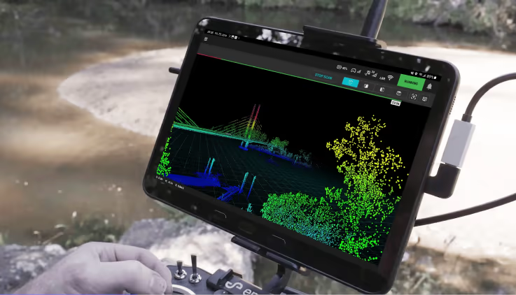
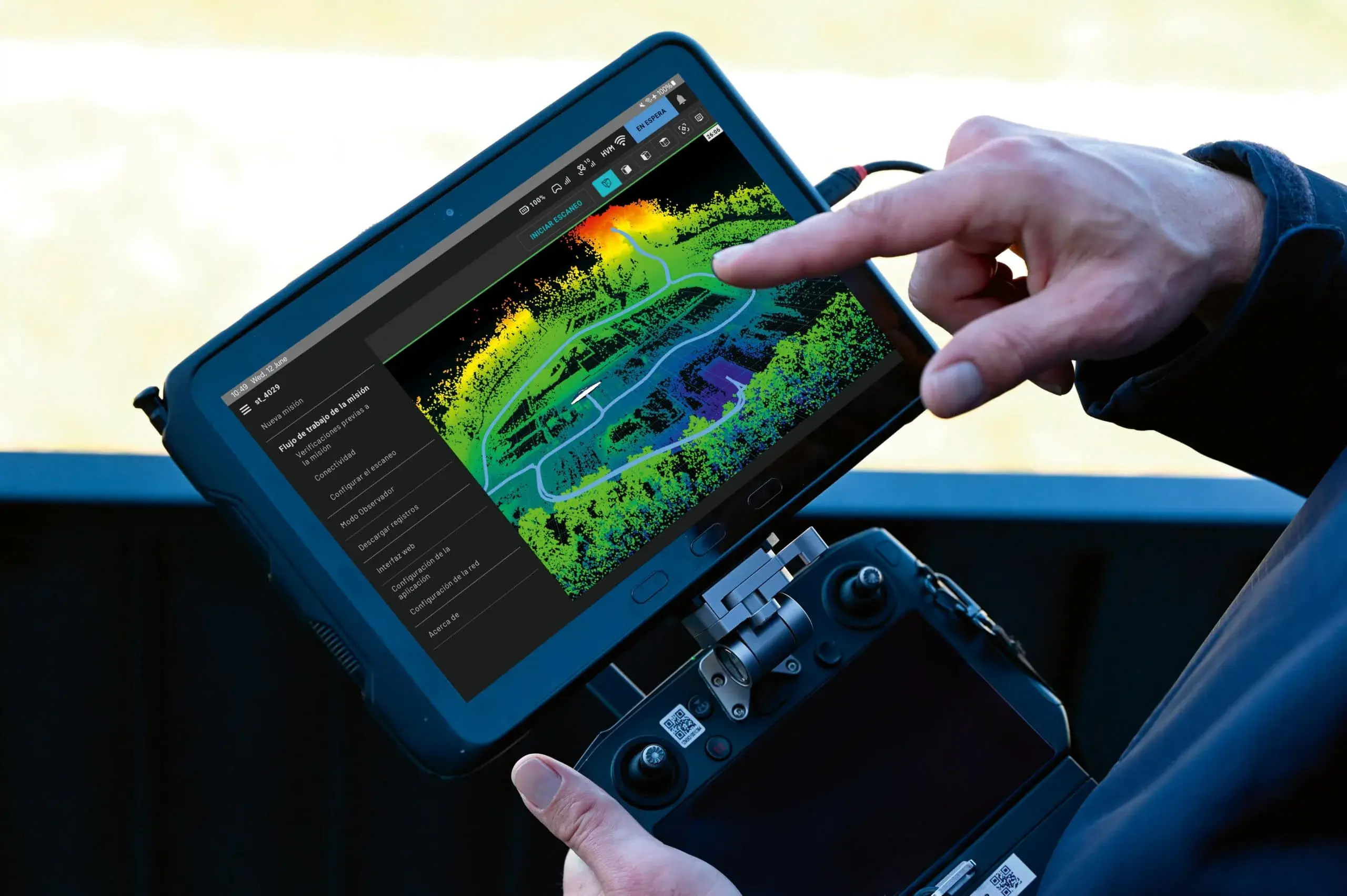
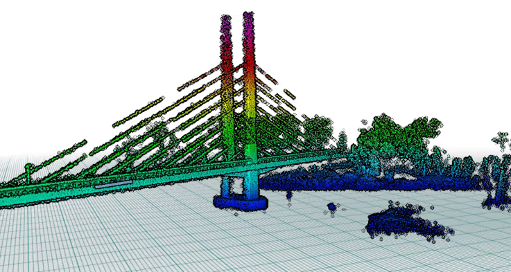
    • Enhanced point cloud visualization

      Commander delivers live visualization with enhanced point cloud quality, clarity and depth perception.

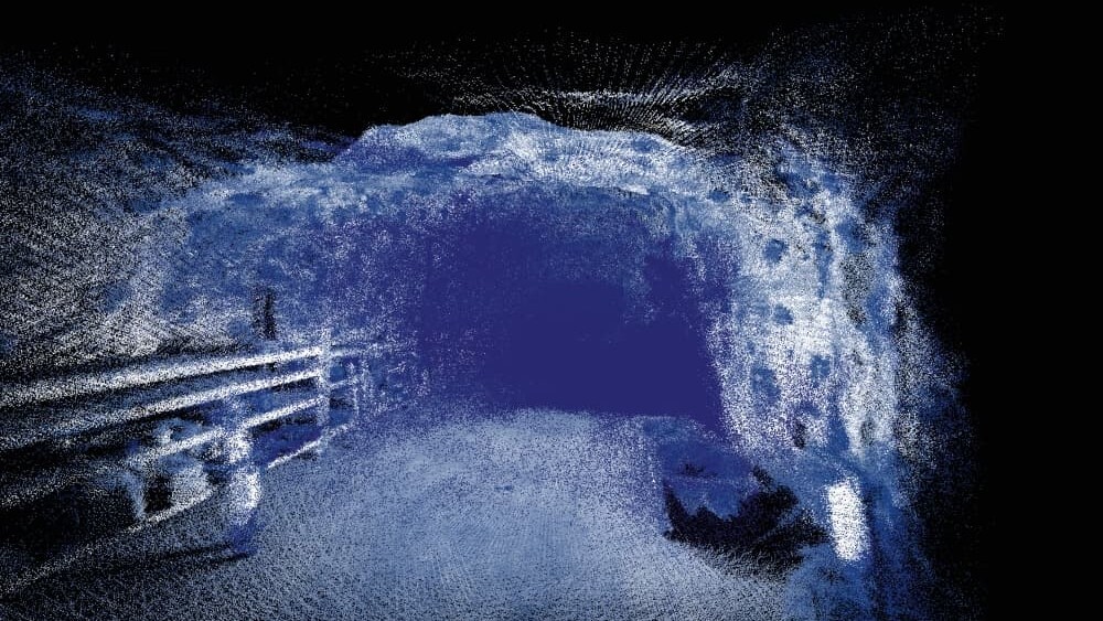
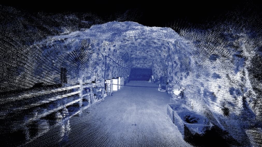
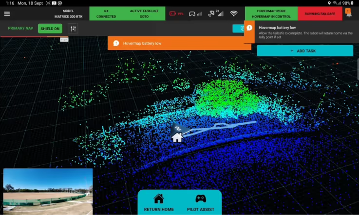
    • Environmental handling improvements

      ​​​Hovermap’s autonomy can detect potentially hazardous environmental conditions such as dense vapor clouds in underground mining stopes and prevent flight into them to keep your device safe.
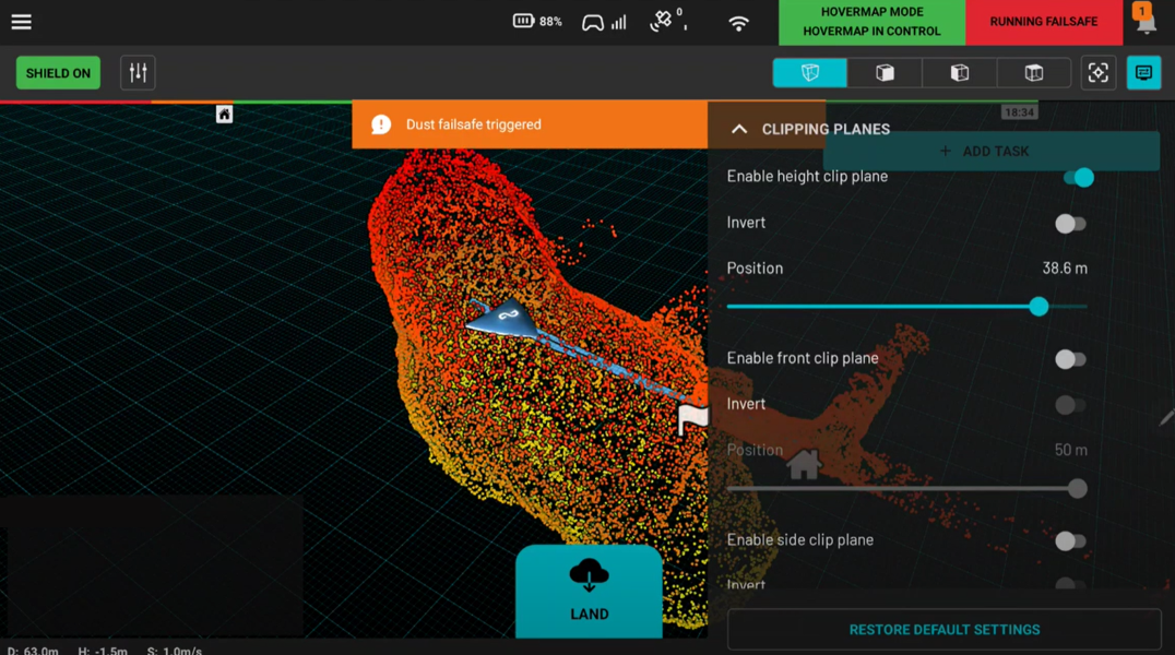
    • Plane clipping

      Create top down or side on cross sections of your scan to expose greater detail or highlight areas of interest and hide the areas you don’t need to see. Ideal for visualizing floor plan detail of a building.

    • Personalized display settings

      Customize your display to your preferences at the swipe of a button to view the live point cloud in the way that suits you best. Easily adjustable settings for bright light environments, field of view, grid overlays, point cloud size, opacity and more.

    Next-gen planning and control

    • Simplified user interface

      A new, intuitive and highly responsive touch screen interface delivers ease of navigation and smooth mission handling. The view of the live streamed point cloud is maximized on screen, while allowing status indicators and active settings to be observed at a glance.


    • Streamlined mission workflow

      Seamless guided workflow for both mapping and autonomous missions provides effortless control and execution.


    • Advanced navigation

      Hovermap automatically selects SLAM (Simultaneous Location and Mapping) as the primary navigation source to ensure optimal data capture and operation – no matter the environment. Hovermap’s exceptional dust filtering capabilities also allow safer, more confident autonomous flying in even the most challenging of environments.


    • Superior obstacle avoidance

      Commander’s Shield function delivers advanced obstacle avoidance capabilities with increased precision, accuracy and range.


    • Clear warnings and notifications

      Pre-mission checks ensure you are set up for scanning success, along with pop-up notifications that keep you informed during the mission and provide guided prompts when action is needed to keep your mission on track.


    • Customize to your local language

      Plan and execute your missions effortlessly in the language of your choice – English, Simplified Chinese, Japanese, Spanish, Italian, Russian, German, French, Portuguese (Brazil).


    • Choice of platforms

      Operate Commander via a tablet, drone controller – or use a smartphone for mobile mapping missions. Automatic device recognition optimizes the interface for use on smaller screens.


    Frequently Asked Questions

    • Emesent Commander is a mission control app for Emesent’s 3D LiDAR mapping scanner Hovermap. Commander makes mapping, pilot assist and autonomous mission planning and control effortless. Designed with user-friendly workflow prompts and built-in fail safes, Commander provides responsive control, ease of navigation and access to Emesent’s market-leading autonomous capabilities via a touchscreen interface.

    • Commander is compatible with Hovermap Firmware 3.0 and later.

    • You can use the Commander app with ST-X, ST and HVM100.

    • Similar to using the previous Hovermap app, it’s your choice to use Commander for mapping. However, if you wish to complete autonomous missions using the latest firmware you need to use Commander.

    • Emesent Hovermap will still function without Commander, however it is recommended to upgrade to the latest firmware and app to benefit from the newest features and the additional context provided to mapping missions.

    • Commander’s Shield prevents a drone from flying into obstacles and is enabled whenever a mission starts. In Autonomous mode, Shield settings are predetermined and cannot be changed. Shield settings may be adjusted when in Pilot Assist mode.

    • Commander’s Task Manager drop down is where you add waypoints. To create a flight plan for your drone, tap the Add Task button to access the Task Manager panel. From there, you define the waypoints that your drone should follow during the mission. In future releases, the Task Manager will include other tasks such as capturing an image or performing rotations.

    Backpack Specifications

    Backpack Specifications

    External Dimensions
    498 mm x 370 mm x 185 mm
    Battery Storage
    Built in battery safety – batteries must be disconnected before stowing Hovermap
    Transportation
    ATA (Air Transport Association) 300 rated and fits in most aircraft overhead compartments
    97Wh batteries are approved to fly on most airlines

    Physical Specifications

    Weight
    4 kg empty
    8.5 kg with accessories