Resource Center Filter by Use CaseResource TypeIndustry Brochures | Case Studies 20+ ways to use Emesent Hovermap in the underground mining lifecycle Brochures | Case Studies 3 ways to transform stope mapping with Emesent Hovermap Brochures | Case Studies Decision Support for CBRNE and HAZMAT Incident Management Case Studies Hovermap Accuracy Report Case Studies Global georeferencing accuracy with Backpack RTK Case Studies Advancing Safety and Productivity in LHD Operations: Mining Plus show what is possible Case Studies Mapping the Carrapateena mega cave: How Hovermap conquered the inaccessible Case Studies Systematic, efficient monitoring of drill and blast operations Case Studies Improving VIP security planning at the Notre Dame de Fourvière Basilica with 3D modelling Case Studies M300/M350 RTK: Improved SLAM accuracy & georeferencing Case Studies Global georeferencing accuracy with Vehicle RTK Case Studies How to optimize your geotechnical monitoring program Case Studies Rapid, comprehensive, versatile 3D data capture for a 2km roadway Case Studies 18 Ways 3D Lidar Scanning Drives Successful Turnarounds Case Studies 22 Ways 3D LiDAR Scanning Elevates Capital Project Execution Outcomes Case Studies Leveraging 3D Data for Decision-Making in Public Safety Case Studies Barrick Bulyanhulu and Kibali: Stope Scanning Case Studies Pinpointing a Blockage in an Inaccessible Hydro Station Tunnel Case Studies Osprey Integrity Speeds up Natural Disaster Recovery with Fast, Accurate Data Capture Case Studies Maintaining Safe Operations at Northparkes Block Cave Mine Case Studies Simplifying Detailed Data Capture to Create a Digital Twin of a Complex Onshore Compressor Station Case Studies Emesent’s High-Quality Mapping And Drone Autonomy Technology Enables The Rapid Creation Of 3D Digital Twins Case Studies GeoZICHT Achieves Entire Traffic Bridge Inspection Case Studies Glencore’s Mount Isa Mines Improves Safety and Productivity in Underground Survey Case Studies Brierley Associates Speeds up road tunnel inspection Case Studies UDM Group Improves Efficiency and Safety for Topographic Surveys Case Studies Kalmar Municipality streamlines digital capture for community planning Case Studies Walden Environmental Engineering Captures New Insights and Revenue Case Studies Glencore Kidd Operations Stope Mapping Case Studies Glencore Kidd Operations Convergence Monitoring Keep up with all the latest at Emesent SUBSCRIBE NOW
Case Studies Improving VIP security planning at the Notre Dame de Fourvière Basilica with 3D modelling
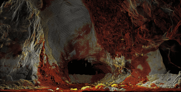
Case Studies Simplifying Detailed Data Capture to Create a Digital Twin of a Complex Onshore Compressor Station
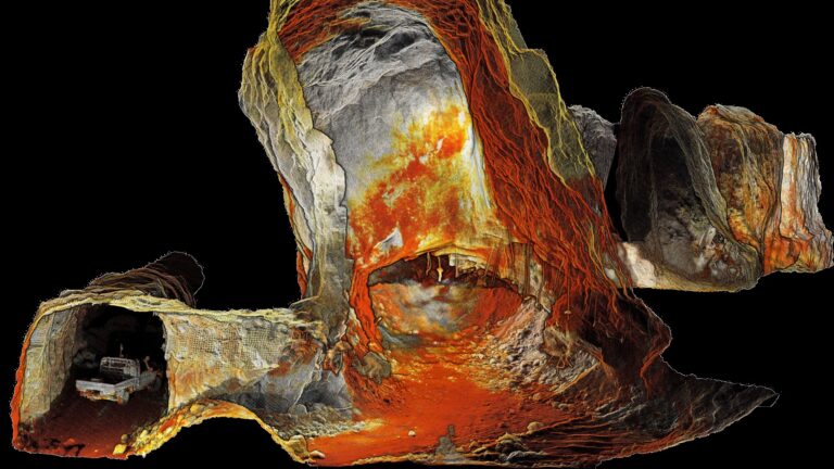
Case Studies Emesent’s High-Quality Mapping And Drone Autonomy Technology Enables The Rapid Creation Of 3D Digital Twins