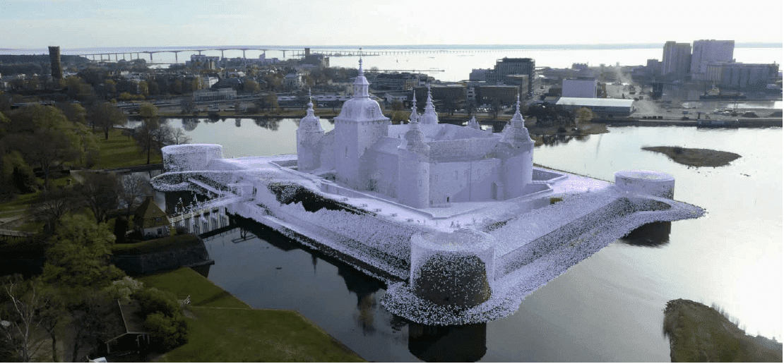
Kalmar Municipality streamlines digital capture for community planning
Kalmar Municipality captured a heritage landmark completely and quickly – a great start to their digital capture of the municipality.
The municipal government of Kalmar, Sweden, embarked on an initiative to digitize its community development process. The project is creating a 3D digital model of historic Kalmar municipality and the surrounding environment and is expected to improve the development planning and public engagement processes. The project commenced with the digitization of the region’s best known landmark: Kalmar Castle.
The Kalmar team contacted geodata and remote sensing specialist AMKVO for help with the trial. Together they were able to improve data capture productivity by 90% and reduce post-processing time by 50%. See how in this case study.