Reduce project risks and costs

    • Keep your AEC projects on track with fast, safe, and flexible data collection using Hovermap.

      Capture high resolution, true-color point clouds to create digital twins of assets such as bridges, buildings, communications towers, tunnels, and more.

      Fast and easily repeatable scans allow you to verify construction and identify potential issues early to reduce rework, helping to keep your projects on track and within budget.

    • Use Hovermap for

      • Project progress monitoring

        A quick data capture process allows for regular scans to monitor construction to ensure the project is tracking against project timelines and is in line with the proposed design.

      • Improved collaboration

        Keep project stakeholders up to date with current data from quick, regular scans. The same datasets can be used across the lifecycle of a project – in design, construction and maintenance.

      • Expedited planning & design

        One quick scan can provide a wealth of understanding of the existing site conditions for new preliminary design work. Use the data to position the project virtually and determine cut, fill, and drainage.

      • Improved decision making

        Scanning versatility allows you to capture the entire asset, from the roof to all the nooks and crannies, ensuring you don’t miss a single detail – especially not the one that could result in a poor decision being made.

      • Restoration work

        Quickly capture accurate as-built data of older structures where no current data exists. Restoration work can then be easily planned with this newly digitized structure, saving time and providing the documentation for future improvements.

      • Increase your competitiveness

        Capture the required data from large areas in less time than traditional methods. Use the most appropriate deployment method for the job (handheld, backpack, drone, vehicle) and merge the results into one unified dataset.

      Request Information
    • Award Winning

    • Capture and visualize survey data for varied use cases

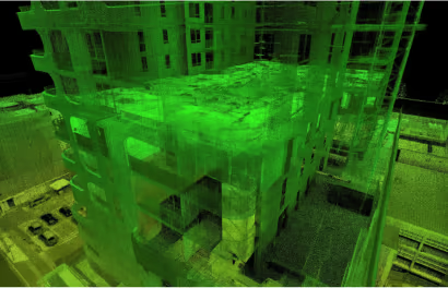
      • Construction Monitoring

        Ensure projects are staying on time, on budget, and to design.

      • Maintenance Planning

        Use the accurate data of existing structures to plan maintenance and facility management.

      • Construction As-Builts

        Capture an accurate as-built condition of existing structures to plan extensions.
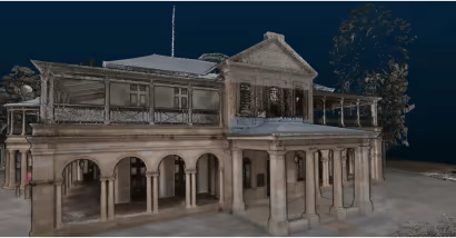
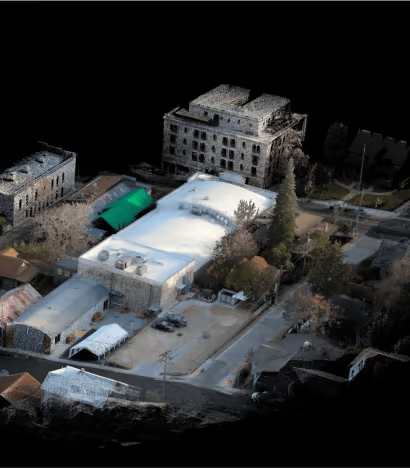
      • Cultural Heritage

        Digitize older structures to update records, plan restoration work, or preserve details for virtual study.
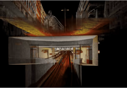
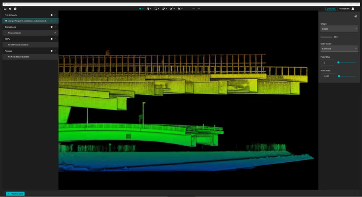
      • Asset Inspection

        Easily capture LiDAR data and inspect images of an entire asset, it’s a bridge, tunnel, or anything in between. View the capture in real-time to be confident you’ve achieved complete coverage before leaving the site.
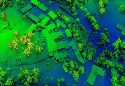
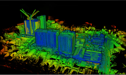
      • Site Planning

        Quickly capture an existing building or construction site for project planning and design. The model can also be used to reduce unnecessary on-site visits with virtual walkthroughs.
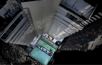
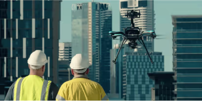
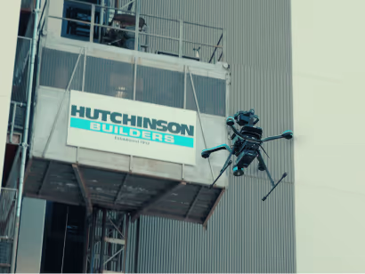
      • Facade Inspection

        Surveying and inspecting building facades is easy with Hovermap’s drone based Collision Avoidance, ensuring capture is possible in challenging GPS compromised urban environments.
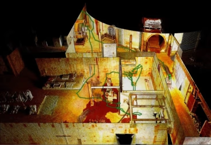
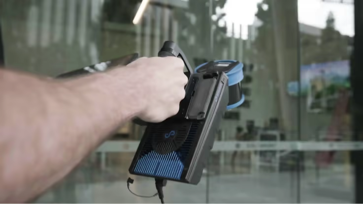
      • Building Internals

        Quickly walk Hovermap through the internals of a building to capture a detailed point cloud to create accurate floor plans or capture internal measurements.

      • Stakeholder Engagement

        Hovermap’s point cloud data provides a richly detailed digital version of the project to share with stakeholders. Enhance visualization with colorized point clouds to improve project understanding.

    • Explore real-life Hovermap applications

      See how Hovermap has saved time and money in engineering and construction around the world

    • Customers using Hovermap

    • Testimonial

      “The Hovermap met our job’s accuracy objectives by achieving absolute accuracy of 40 mm, based on 10 control points evenly distributed across the 2.5 ha site. This is an impressive outcome for a SLAM scanner.”

      Alexander Paulusson
      CEO
      AMKVO
    • Why use Hovermap?

      • Speed of capture

        Hovermap’s SLAM-based mobile mapping allows for the capture of data up to seven times faster than traditional methods. The powerful combination of precision engineering, world-leading SLAM algorithms, and robust drone autonomy capability provides accurate LiDAR mapping.


      • Unique versatility

        The plug and play design and quick-release mechanism allow easy switching between modes. Use Hovermap as a handheld scanner; attached to a drone, vehicle, or pole; lowered in a cage; or mounted to a backpack to easily collect data anywhere. The compact, lightweight design makes it easy to carry and provides longer flight time.


      • Accurate, adaptable data

        The accurate and dense point clouds captured by Hovermap can easily be processed into necessary project deliverables, including CAD and 3D BIM models, using industry standard tools, such as PointCab, PointFuse, or Revit/AutoCAD.


      • PointCab Origins integration

        This integration enables PointCab Origins to automatically detect a Hovermap scan and selects the project settings for the best results, resulting in clear images with more accurate vectorization. It will streamline the point cloud to model workflow, saving users time.

        Learn more

    Get in touch with our team of experts