Welcome to our 101 series, where we take a beginner’s look at LiDAR, mobile mapping, digital twins, and all things Hovermap related. This article explores the pros and cons of popular digital survey technologies.
A digital twin is an exact digital representation of a real-world space. Digital twins are used in various industries, from automotive to healthcare to aerospace. They have also been found to bring great value to the mining, construction, and inspection industries. As such, they are fast becoming a must-have in many projects.
Having a model that accurately reflects the asset with real-time information can improve decision-making. For example, they allow the tracking of critical metrics during building construction to verify work is progressing as intended and identify potential issues early to reduce rework and ensure the project remains on time and budget. Within the mining industry, they can be used to set a baseline for monitoring which allows for the tracking of deformation over time and can help planners determine whether drifts and tunnels should be reinforced or abandoned for alternative means. For inspections, digital twins also provide a baseline for monitoring and maintenance during the life of an asset.
There are a number of options when it comes to data capture for creating digital twins. Two of the more popular are mobile LiDAR scanning and photogrammetry. Let’s take a look at both options and the benefits of each.
What is LiDAR
LiDAR, or Light Detection and Ranging, is a sensing method that measures distances based on the time-of-flight of a pulse of laser light. In mobile scanning, a SLAM (Simultaneous Localization and Mapping) algorithm allows the LiDAR to produce a 3D map (known as a point cloud) of the scanned asset.
Point clouds can be processed into 3D models and, with the addition of extra information, can become BIM models or digital twins.
Mobile LiDAR scanners are available as handheld scanners or mounted to drones or ground robots to capture the required data.
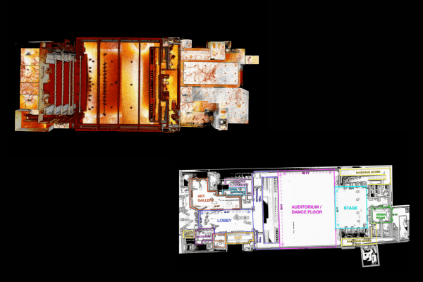
LiDAR scan of an Arts Centre and the resulting floor plan model
What is Photogrammetry
The process of photogrammetry involves capturing many overlapping images of the same asset. These images are processed by photogrammetry software, using multiple views to triangulate its x, y, and z coordinates in space to produce a point cloud. The software will then use ortho-rectification, or image stitching, to fit images together and combine them with the point cloud for a photorealistic digital model, which can become a digital twin.
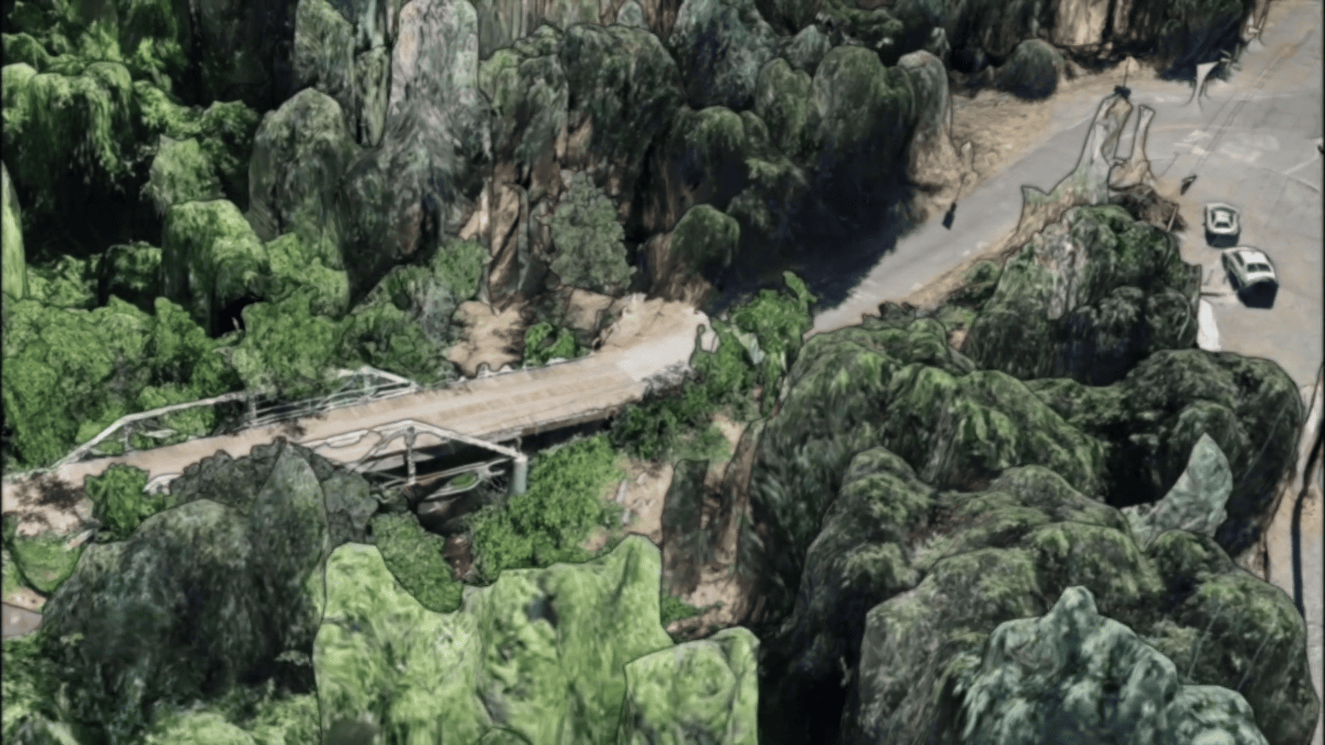
Image captured with photogrammetry (courtesy of EROCK)
Photogrammetry can be captured through handheld or drone-mounted equipment.
These technologies have various advantages and disadvantages depending on the application, so understanding these can help to ensure the most appropriate technique is used for your application. Here’s a summary of some key attributes to consider.
Accuracy
As LiDAR is a direct measurement, it can be more accurate than photogrammetry (an inferred measurement), although the accuracy of both methods can be improved with post-processing workflows.
In both methods, the addition of ground control points can improve accuracy. Post-processing features like Hovermap’s Automated Ground Control can streamline your workflow by automatically detecting the reflective ground control targets in the point cloud and using them to georeference the LiDAR point cloud and improve accuracy.
Speed
To generate an accurate 3D model, photogrammetry requires an image overlap of up to 80%. If capturing with a drone flight, this requires a particular flight pattern to ensure enough overlap, which can be time-consuming. In contrast, LiDAR scanning doesn’t require as much overlap, so the flight can be more efficient for data capture.
For LiDAR, the processing time to 3D output is significantly faster. For example, the processing time for Hovermap LiDAR data is approximately equivalent to the scanning time.
Convenience
The equipment for photogrammetry tends to be a little lighter, making it easier to get to the site or a smaller payload for a drone.
As LiDAR uses lasers, it works in many more lighting conditions than photogrammetry, allowing you to capture more in the day and work on days where the lighting might not be suitable for photogrammetry. This also makes LiDAR ideal for underground work, for example, in mines.
Vegetation Penetration
LiDAR can penetrate vegetation for ground detection, making it ideal for ground surveys. Vegetation can easily be removed in post-processing, leaving you with an accurate topographical survey.
Often, photogrammetry will only detect the top of the canopy, making it difficult to capture an accurate ground scan.
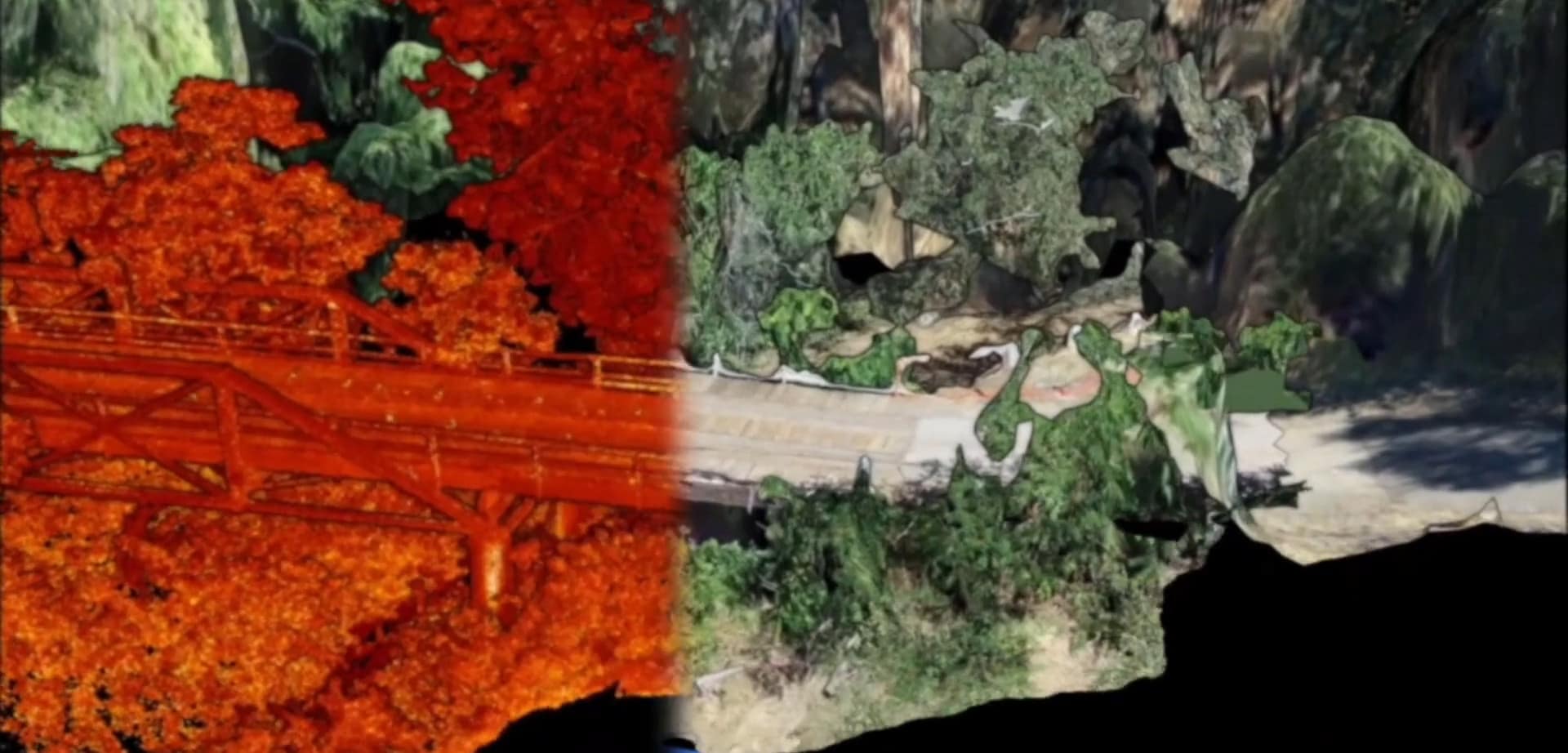
Image: photogrammetry vs LiDAR scan with vegetation. Image courtesy of EROCK.
Realism
As photogrammetry stitches together photos to create your model, the models are as true to the real world as possible.
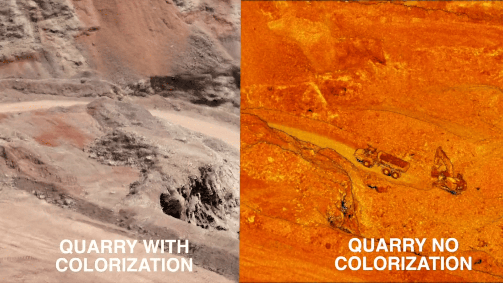
LiDAR point clouds can appear abstract, however, the addition of true color colorization can improve the level of realism of the point clouds.