Emesent delivers greater point cloud accuracy, offering versatile RTK support for its mobile mapping solution
Emesent, the gold standard in SLAM-based mobile reality capture and a global leader in autonomous digital mapping, will demonstrate its breadth of versatile scanning solutions at the upcoming Geo Week event, booth #1221 at the Colorado Convention Center, 10-12 February.
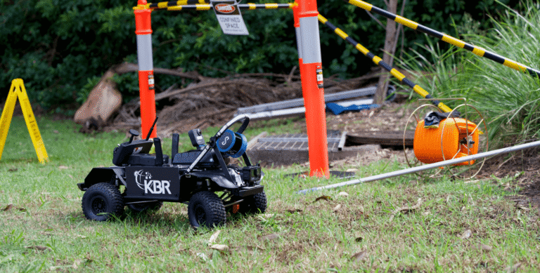
For over 6 years, Emesent has offered advanced mapping solutions for challenging, GPS-denied and inaccessible environments such as those found in mining. With the incorporation of support for real-time kinematics (RTK), Emesent has applied the capabilities of the award-winning LiDAR scanner Hovermap to similarly complex built environments.
Focusing on the flexibility and strength of its technology, Emesent will showcase:
- How Emesent Hovermap seamlessly combines SLAM and RTK data to enable highly accurate georeferencing via drone, vehicle and backpack.
- Support for Trimble, Emlid and Leica GNSS receivers to enable RTK on clients’ preferred receivers.
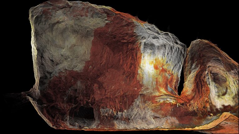
With recent updates to its data processing and visualization software, Emesent will demonstrate 360-degree images displayed within Aura, with automatic geolocation and image overlaying, offering additional context for captured point clouds.
In keeping with its strong commitment for US-made solutions, Emesent will also feature integration with the Freefly Astro Max drone, with 3kg payload capacity and high-definition colorized point clouds.
For the first time in the US, Emesent will display the world’s only golden Hovermap. Geo Week attendees have a chance to win the fully functioning Emesent Hovermap ST-X, a 1-year mapping subscription and exclusive golden transport case. Further details about how to enter the lucky draw are available on the Emesent website.
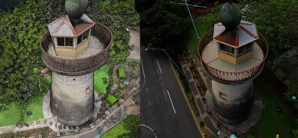
At last year’s Geo Week, Emesent participated in a scanning accuracy test coordinated by the U.S. Institute of Building Documentation (USIBD). This year members of the team will be available to run through the results – which placed Emesent Hovermap at the head of the pack for accuracy, with and without the use of GCPs – with attendees able to download the accuracy report and related sample data via the Emesent booth.
Geo Week attendees are also invited to join the Golden Hovermap Trail. The first 50 people to collect stamps from Emesent’s Geo Week Partners – Trimble booth #1203, Prevu3D booth #1029, Pointerra booth #846, Frontier Precision booth #821 , Get Kids Into Survey booth #745 – will receive a prize. More information will be available at Emesent’s booth #1221.
Potential clients interested in understanding Emesent’s latest solutions, partner integrations, and data capture quality are encouraged to discuss their questions and requirements with the Emesent Geo Week team by first organizing a time, which can be arranged by registering here.
More information about Emesent products, solutions and technology is available at emesent.com.
Related Resources