
Emesent’s Director of Product, Christian Skinner, outlines how the recent upgrade to Emesent Hovermap’s autonomous capabilities delivers better outcomes for underground mining operators, helping reduce risk while providing more actionable data.
For underground mine surveyors, delays and dangers are all too familiar. But what if you could have immediate, high-precision stope maps at your fingertips — without ever stepping into harm’s way?
The problem with traditional surveys
Underground mining presents relentless challenges for surveyors and operational leaders. Traditional Cavity Monitoring Systems (CMS) require manual operation at the stope edge — exposing personnel to hazardous falls, air quality risks, and geotechnical hazards. These systems are slow, capturing limited data with each scan and often missing critical information in inaccessible or dangerous environments.
For many surveyors, every scan means hours of setup and manual piloting, only to receive incomplete datasets that delay key decisions and production schedules. The result? Increased safety risk, mounting operational costs, and lost opportunities to optimize mine productivity.
The Innovation: Next-Gen Stope Mapping with Hovermap
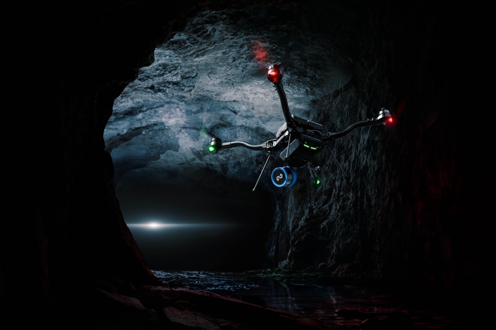
Emesent’s fully autonomous stope mapping solution, powered by Hovermap, redefines underground surveying. Already trusted by over 200 hard rock mines globally, Hovermap delivers breakthrough autonomy, data quality, and ease of use. Designed specifically for the harshest mining environments, it’s the only solution you need to safely, quickly, and thoroughly map complex stopes - no pilot, no line of sight, and no guesswork.
Simplicity and speed
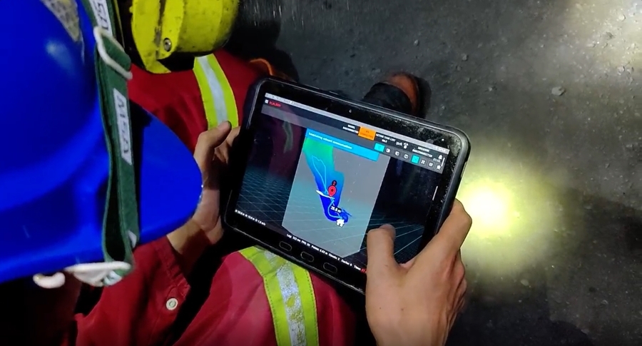
Deploying Hovermap is as easy as defining your virtual scan boundary in Commander, Emesent’s intuitive mission app. With minimal training, a single surveyor can be ready to scan in under five minutes. Hovermap autonomously explores the stope — even navigating passages as narrow as 2.4 meters — and delivers instant, in-field point clouds with onboard processing. No specialized piloting skills required; no need for constant radio link; just fast, safe, repeatable mapping.
It's a better operational model
The latest capabilities in Hovermap transform the traditional way data is collected, analyzed and used. Instead, Emesent’s stope mapping solution strengthens safety standards and workflows. It can be described this way:
- Without Hovermap: Surveyors spend hours at the stope edge, piloting CMS, risking falls, and often capturing incomplete datasets that required repeat visits.
- With Hovermap: A single operator can launch an autonomous scan in minutes from a safe distance and walk away with complete, validated data ready for analysis.
The following is the kind of feedback we are already receiving about the new release:
“We used [Emesent Hovermap’s] exploration to scan a large broken ore pass last week and it captured everything.” — Senior Mine Surveyor, Mount Isa Mines
With thousands of successful deployments worldwide and trust from over 200 mines — including major operations in Australia, North America, and Africa — Emesent’s Hovermap is setting the global benchmark for autonomous underground mapping.
Here’s why:
- Hovermap is field-proven: Deployed in some of the world’s harshest mining environments
- Hovermap offers battle-tested reliability: Delivering immediate ROI and peace of mind for mine operators and surveyors
See for yourself how Glencore Kidd Operations use Hovermap to map stopes with speed and precision:
If you’d like to learn more, visit our Autonomous Stope Mapping solution page or book a demo today and see first-hand what fast, safe, and fully autonomous mapping looks like.