-
Scan to BIM
Expedite design and inspection with rapid, detailed 3D data capture
-
Capture a more comprehensive dataset and avoid expensive revisits
The construction industry relies on 3D Building Information Modeling (BIM) to plan, design, construct, and manage buildings and infrastructure. Yet traditional data capture methods such as terrestrial laser scanning (TLS) can be time-consuming and labor-intensive.
With Hovermap’s advanced 3D LiDAR scanning technology, capturing as-built conditions for conversion into detailed BIM models is faster and more efficient than ever. This streamlined approach delivers up-to-date, high-accuracy data in a fraction of the time — enabling more frequent scanning, real-time progress tracking, and better decision-making across the project lifecycle.
Traditional methods can slow you down
Traditional scanning methods, especially with terrestrial laser scanning (TLS), are labor-intensive and time-consuming — particularly in complex buildings or infrastructure projects that require multiple set-ups. This not only drives up costs during capture and post-processing but also limits the ability to scan frequently enough for effective progress tracking. As a result, maintaining a live digital twin becomes difficult in the fast-paced world of construction. Accurate data capture demands specialized training and expertise, adding to project complexity. Moreover, while TLS provides high-resolution 3D data, it often needs to be supplemented to access hidden or hard-to-reach areas. Environmental conditions like weather, lighting, and physical obstructions can further compromise scan quality.
-
The Emesent Solution
Hovermap, Emesent’s versatile LiDAR mapping solution, transforms Scan to BIM workflows by enabling highly accurate, efficient, and flexible data capture — reducing scanning time by up to 90% compared to traditional terrestrial laser scanning (TLS).
Hovermap accelerates the Scan to BIM process with rapid scanning and multi-platform deployment: use it handheld or on a backpack for tight or indoor spaces, or mount it to a drone or vehicle for fast scanning over large areas. Whether capturing expansive exteriors or intricate pipework, Hovermap ensures comprehensive, high-resolution coverage — even in GPS-denied environments. The simplicity and speed of scanning make it easy to capture data more frequently, enabling live digital twins for enhanced progress monitoring, real-time updates, and ongoing comparisons against design.
Captured data is processed and automatically georeferenced using Emesent Aura software, producing accurate point clouds ready for direct integration into 3D BIM software. The result is an as-built model that mirrors real-world conditions — ideal for clash detection, progress tracking and ongoing management.
When it comes to Scan to BIM, Hovermap eliminates the delays of traditional terrestrial laser scanning, allowing project teams to make faster, more informed decisions with accurate, up-to-date site information.
-
Data capture in minutes
Fast and accurate data capture, at least 10x faster than traditional methods — even in hard-to-access or GPS-denied areas
-
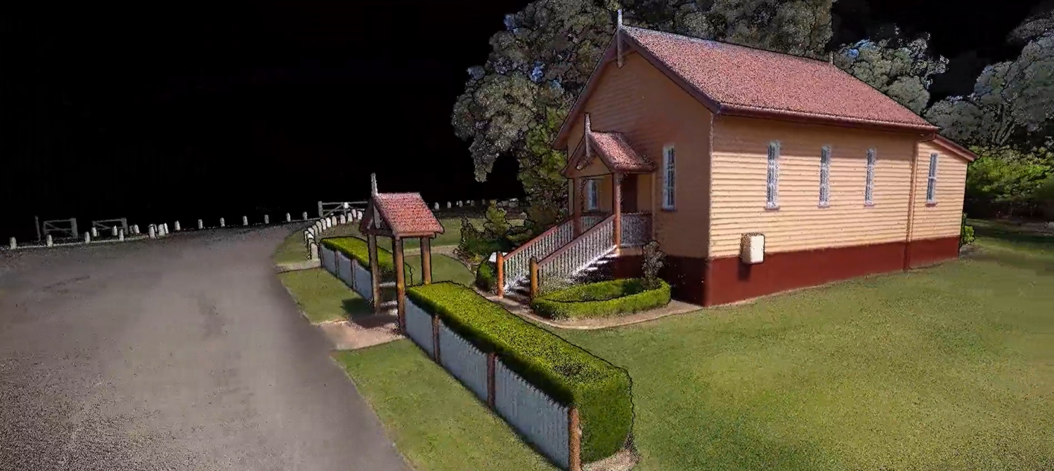
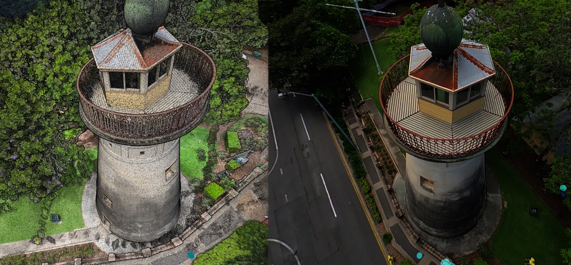
High density colorized scans
Hovermap’s high-density data capture ensures detailed 3D colorized models
-
Accurate results
Capture precise 3D spatial data and intricate structural detail including walls, ceilings, floors, MEP and HVAC systems
-
Rapid, large scale capture
Efficient for complex or large-scale sites such as high-rises, tunnels, industrial plants
-
Versatile deployment
A single Hovermap can be deployed on multiple platforms, ensuring comprehensive coverage from intricate pipes to large areas
-
Faster workflows
Allows continuous scanning and non stop image capture with automated target detection and georeferencing — no need to touch each control point
-
-
Operational workflow
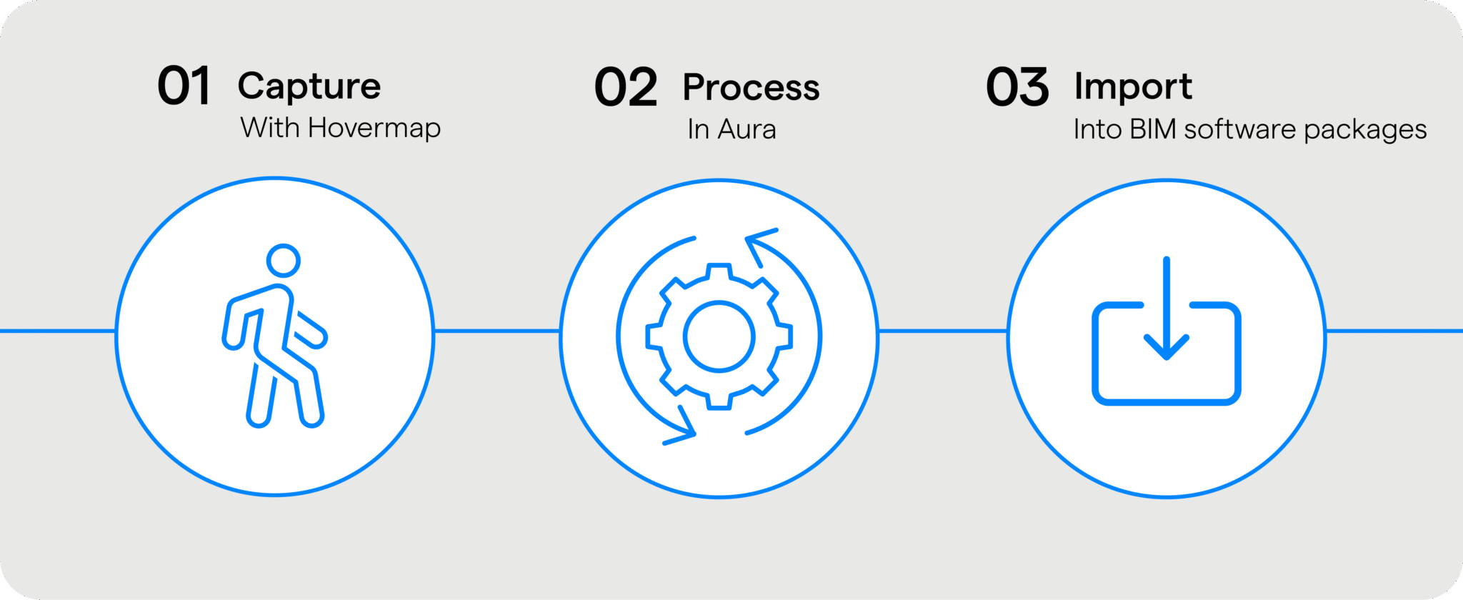
- Deploy Hovermap mounted on a drone or vehicle for rapid, large area continuous scanning, or handheld for smaller areas.
- Process, automatically georeference your dataset in Aura with RTK or GCPs, merge, clean and prepare.
- Easily import into BIM software for modelling.
-
Transform Your Built Environment with Fast, Accurate Scan to BIM
-

Versatile deployment
Plug-and-play design allows easy switching between platforms — hand-held; attached to a drone, vehicle, or pole; lowered in a cage; or mounted to a backpack
-

Lightweight, compact form factor
For single-handed or hands-free scanning, unhindered by tight spaces or complex environments
-

Stream as you scan
Real-time 3D visualization of the environment via the Commander app
-
360° Colorization
Add additional context to your point clouds, uncovering richer insights and aiding stakeholder understanding
-
360° Image capture
The same scan can be used to extract 360° images which can be viewed side-by-side with the point cloud to highlight areas of interest
-

Survey-grade results
Best-in-class SLAM, combined with automated georeferencing to further enhance results
-

Merge multiple datasets
Capture scans at different times and in different areas and easily merge together
-
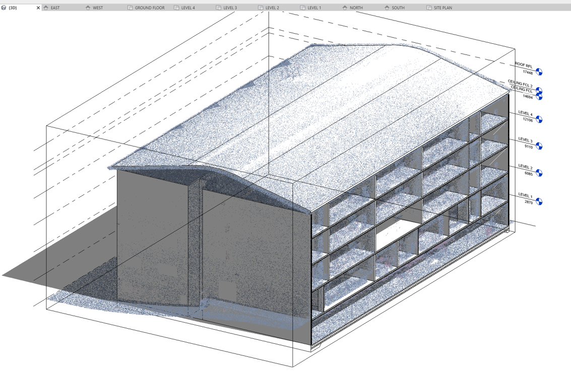
Software integration
Import into BIM software packages such as Autodesk Revit and Bentley Systems OpenRoads Designer
-

Set-and-forget processing
With automated cleaning tools that include removing moving objects from your environment
-
-
-
Related content
-
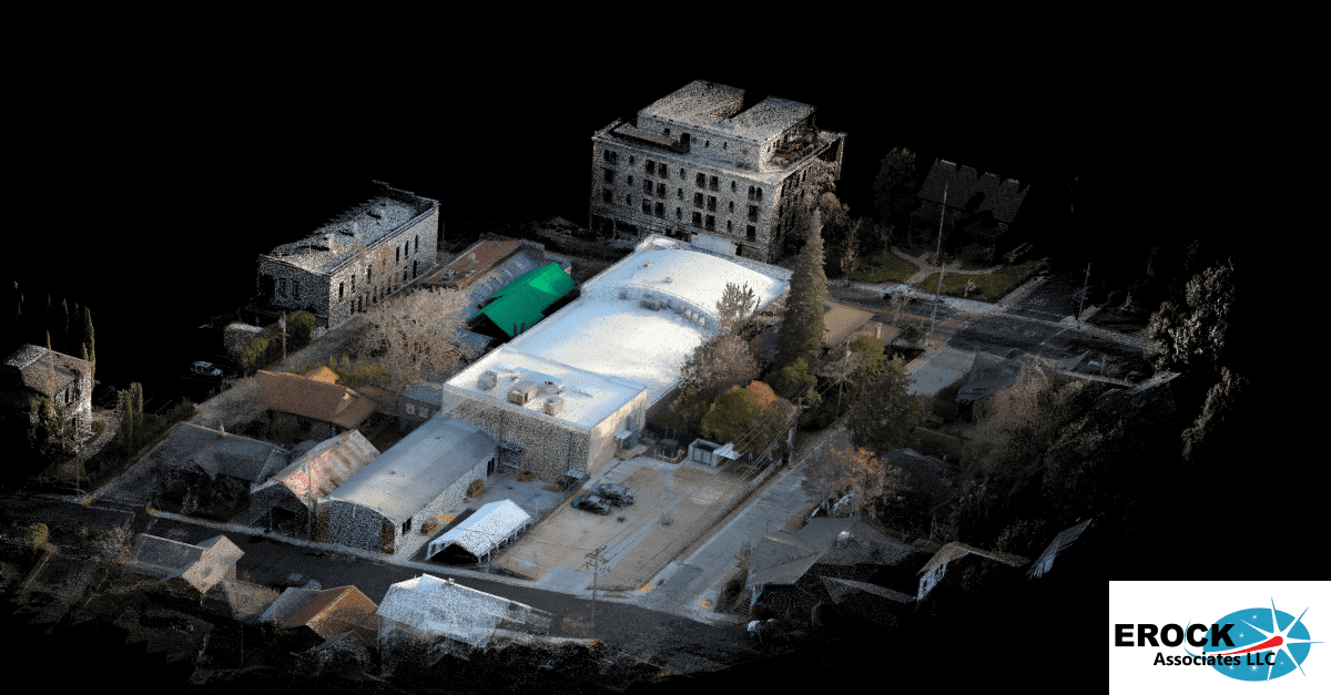
Grass Valley Center for the Arts optimizes operations with Hovermap
-

Scan to BIM – Elevator shaft
-
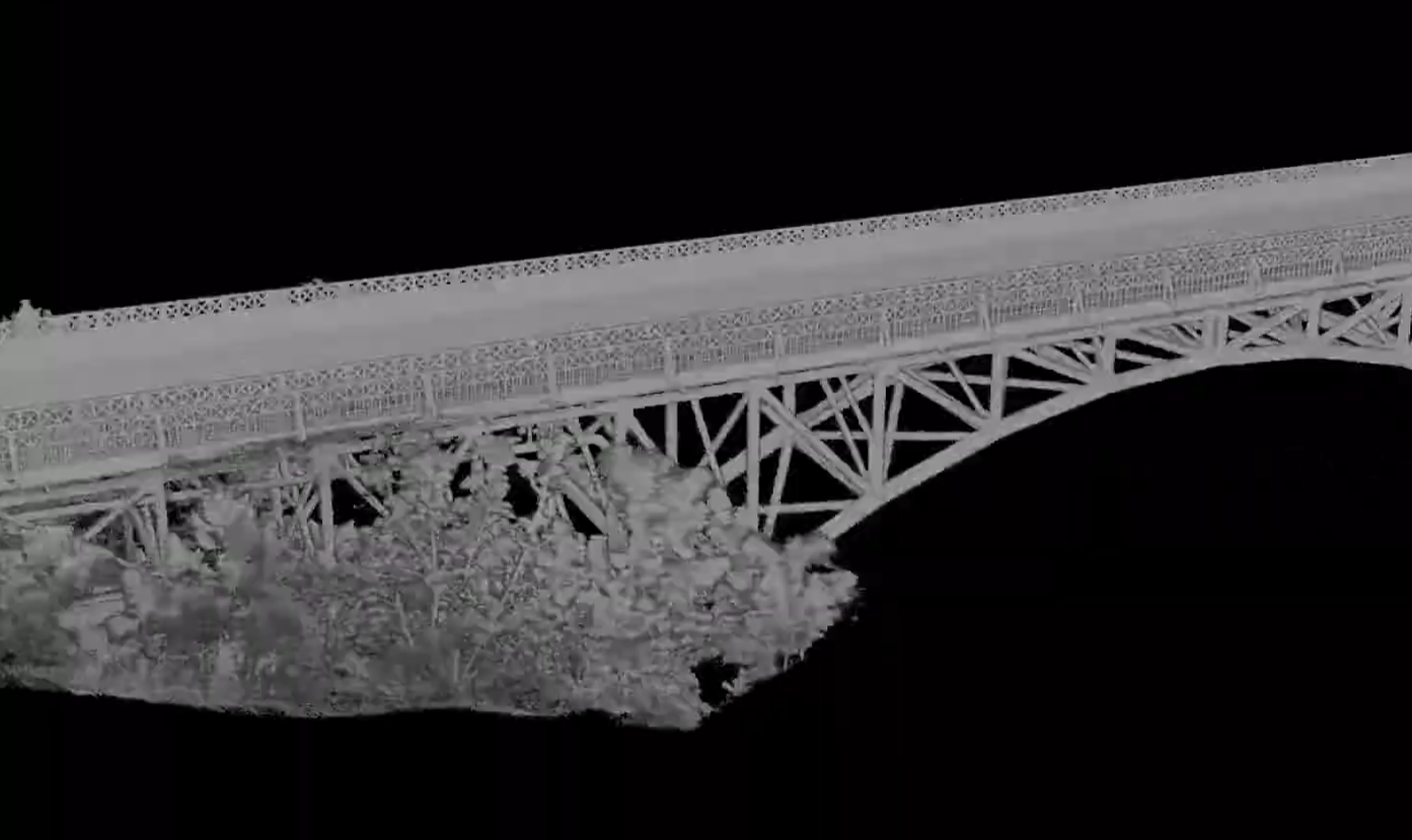
Scan to BIM – Pine Street bridge
-
-
Want to see more?
Enquire Now