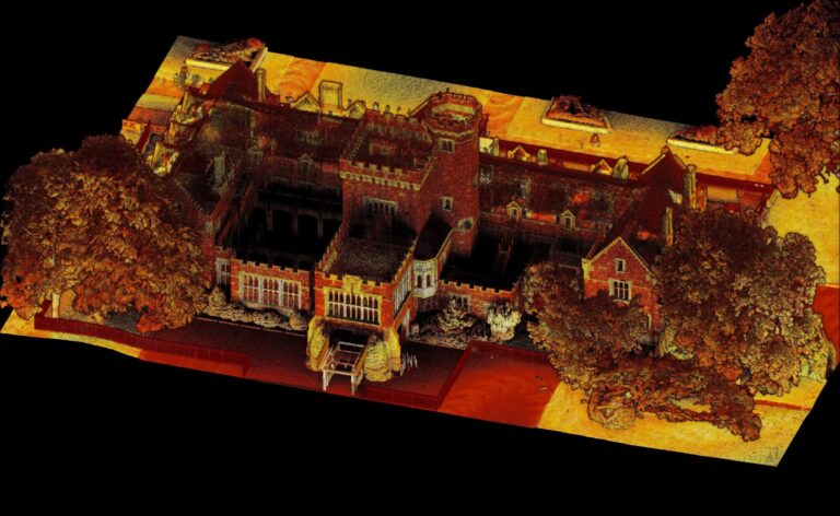
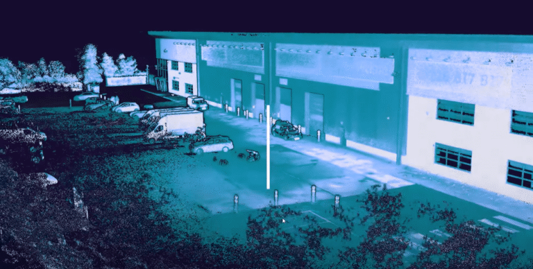
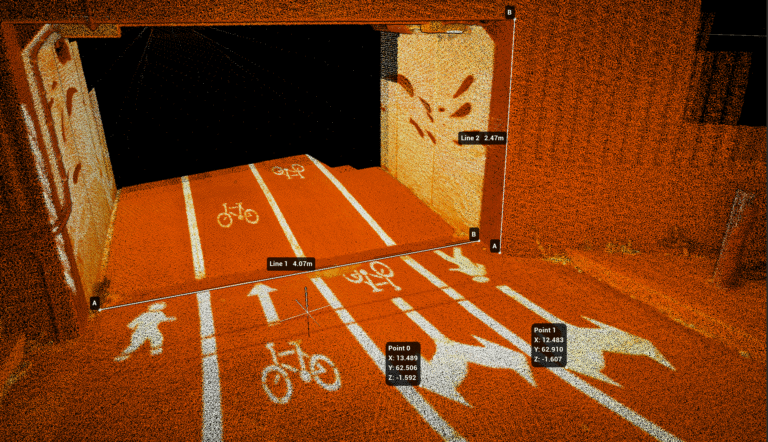
Aura 2.0 – More flexibility, increased confidence
Emesent’s Senior Product Manager Greg Davis shares how Aura 2.0 is unlocking hours of additional productivity with its latest enhancements.
With concurrent user licensing, user-selected targets, and enhanced accuracy validation, Aura 2.0 transforms how Emesent Hovermap users process their LiDAR data.
The latest release of Emesent Aura offers a better way to work with Hovermap LiDAR data. Gone are the days of a single user license tied to a physical dongle. Instead, teams will now have the flexibility to work with Aura around the clock and across multiple locations.
Hovermap users BIM Manufacture share 3 real-world projects showcasing the speed, flexibility, and accuracy of Emesent Hovermap and hybrid scanning techniques.
Emesent’s Director of Product, Christian Skinner, outlines how the recent upgrade to Emesent Hovermap’s autonomous capabilities delivers better outcomes for underground mining operators, helping reduce risk while providing more actionable data.
AirborneLogic presents case studies on how they use the Emesent Hovermap ST-X to accurately measure trees, carbon and biodiversity in an effort to quantify natural capital and help regenerate our environment.
Russian-language webinar: Meet Micromine, a mining software company that provides Hovermap-integrated solutions for the exploration, modeling, design, and operation of mining projects and highlights the value of LiDAR integration for underground surveying.
Download this eBook to discover how Emesent’s SLAM based LiDAR Hovermap empowers mining users to work smarter, reduce operational risks, and access accurate, actionable insights faster than ever before.
Collaboration between Emesent and KBR combines SLAM-based LiDAR scanning, HD 360-degree camera imagery, and a remote-controlled vehicle, for accurate and efficient sewer inspections
From overhead powerlines, substations and transformers, to buried cables and renewable assets, in this webinar with Gridvision we explore how Emesent Hovermap fills the critical gaps left by traditional aerial surveys.