Emesent launches Aura 2.0: Extending Hovermap’s legendary versatility to improved ground control point workflows
New concurrent user licensing, user-selected targets, and enhanced accuracy validation transform how AEC and mining professionals approach LiDAR-based surveying
Emesent, a leading developer of autonomous mapping solutions, today announced the release of Aura 2.0, a major upgrade to its mapping visualization and processing software that delivers unprecedented flexibility and accuracy for architecture, engineering, construction (AEC) and mining professionals.
Aura 2.0 transforms how Emesent Hovermap users process their LiDAR data, addressing the most pressing challenges faced by surveying teams: concurrent user licensing that eliminates hardware dongle limitations, user-selected targets that provide flexibility over georeferencing workflows, and check point validation for streamlined accuracy reporting.
Solving Critical Industry Pain Points
The new concurrent user licensing system represents a fundamental shift from traditional physical dongles that have long hindered distributed teams. Companies with operations spanning multiple locations and time zones can now seamlessly share processing capabilities across their workforce.
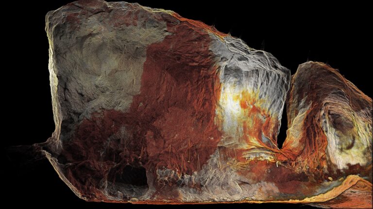
The user-selected targets feature brings Hovermap’s renowned versatility directly into the ground control point (GCP) workflow, allowing users to select any identifiable targets in their point cloud data—from checkerboards and paint marks to existing infrastructure elements in their environment.

Enhanced Accuracy and Streamlined Workflows
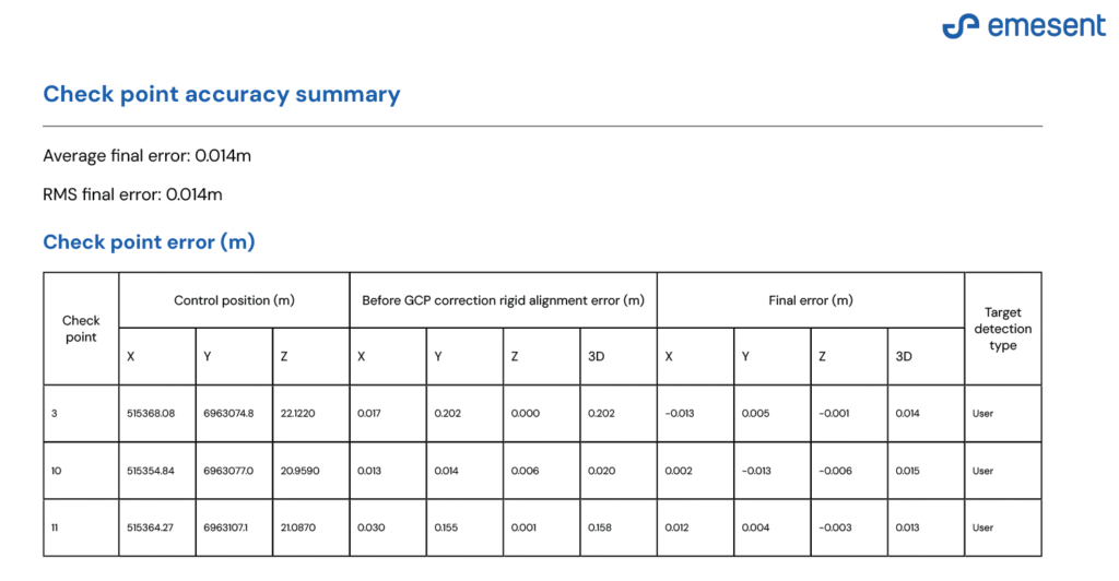
Aura 2.0’s check point validation system provides instant accuracy verification through automated comparison of user-designated check points against corresponding coordinates from point cloud target locations.
The system generates comprehensive accuracy reports in both PDF and CSV formats, eliminating the need for third-party software for accuracy validation.
The software also leverages non-rigid SLAM correction—unique to Emesent’s technology—which improves accuracy and reduces drift in complex, dynamic, and GPS-denied environments. This capability is particularly valuable for large outdoor areas and featureless GPS-denied environments.
Additional workflow improvements include redesigned measurement tools, enhanced processing tray usability, and intelligent data validation warnings that alert users to corrupted or incomplete datasets before processing begins, saving valuable time.
Democratizing Advanced Surveying Technology
“Aura 2.0 represents our commitment to breaking down the traditional barriers that have limited surveying teams’ ability to work efficiently across distributed environments,” said Dr. Stefan Hrabar, Co-founder and Chief Strategy Officer at Emesent.
By eliminating the constraints of physical dongles and giving users complete control over their target selection and accuracy validation processes, we’re enabling surveying professionals to focus on what they do best—delivering precise, reliable data to their clients fast—rather than wrestling with software.”
– stefan Hrabar, Co-Founder & CHief Strategy Officer
Proven Performance in Real-World Applications
Aura’s impact extends beyond technical specifications to real operational benefits. The user-selected targets feature has proven particularly valuable for clients working in challenging environments where traditional targets are impractical.
Daniel Janko from LKAB Sweden noted:
“Most of the scans we do with Hovermap are places where we can’t enter due to seismic events or rockfalls and can’t install temporary targets.” He goes on to explain: “Being able to select control points in Aura from paint marks or other features in the point cloud enables us to rapidly scan and complete documentation for rock mechanics in those inaccessible areas.”
Speaking as an early test user, Mark Olynyk, 2IC Surveyor at Newmont Australia’s Tanami Operations, also liked the flexibility offered by the new licensing system: “We often have team members working remotely, so the flexibility that concurrent user licensing has provided is great for us.”
Improving Productivity for Modern Surveying Operations
Aura 2.0 delivers three key client benefits: greater flexibility through processing from any location on any compatible machine without hardware dongles; faster deployment through immediate data processing upon user login; and reduced downtime by eliminating risks associated with lost or damaged dongles.
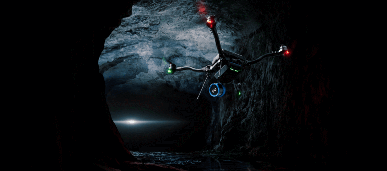
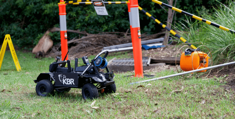
The software supports Hovermap scans captured via handheld, backpack, drone, or vehicle deployments, delivering the high level of versatility that clients have come to expect from Emesent Hovermap’s SLAM-based mapping capabilities.
Availability
The latest version of Emesent Aura 2.0 is available for download for existing users via Emesent’s dedicated client portal.
Emesent Hovermap and related accessories can be purchased via Emesent’s global network of partners. View information about Hovermap ST and ST-X here.
For more information visit the Emesent Aura webpage or contact us.
Related Resources