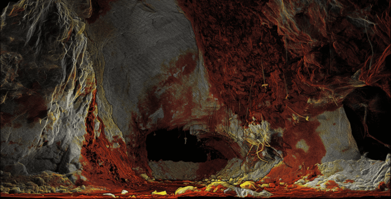
From Hospital to Forest: Unlocking deeper insights through faster reality capture
Hovermap users BIM Manufacture share 3 real-world projects showcasing the speed, flexibility, and accuracy of Emesent Hovermap and hybrid scanning techniques.

Hovermap users BIM Manufacture share 3 real-world projects showcasing the speed, flexibility, and accuracy of Emesent Hovermap and hybrid scanning techniques.
Emesent’s Director of Product, Christian Skinner, outlines how the recent upgrade to Emesent Hovermap’s autonomous capabilities delivers better outcomes for underground mining operators, helping reduce risk while providing more actionable data.
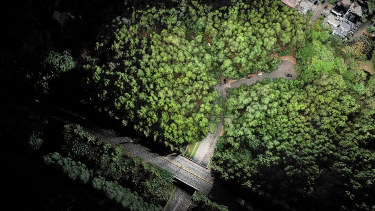
AirborneLogic presents case studies on how they use the Emesent Hovermap ST-X to accurately measure trees, carbon and biodiversity in an effort to quantify natural capital and help regenerate our environment.
Russian-language webinar: Meet Micromine, a mining software company that provides Hovermap-integrated solutions for the exploration, modeling, design, and operation of mining projects and highlights the value of LiDAR integration for underground surveying.
Download this eBook to discover how Emesent’s SLAM based LiDAR Hovermap empowers mining users to work smarter, reduce operational risks, and access accurate, actionable insights faster than ever before.
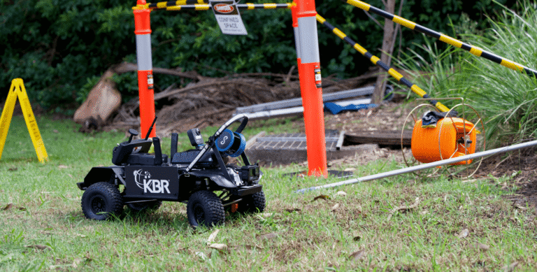
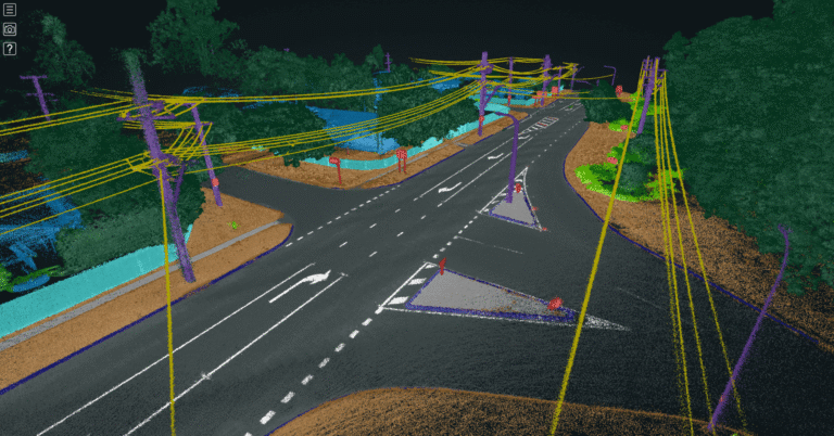
Collaboration between Emesent and KBR combines SLAM-based LiDAR scanning, HD 360-degree camera imagery, and a remote-controlled vehicle, for accurate and efficient sewer inspections
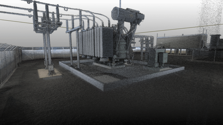
From overhead powerlines, substations and transformers, to buried cables and renewable assets, in this webinar with Gridvision we explore how Emesent Hovermap fills the critical gaps left by traditional aerial surveys.
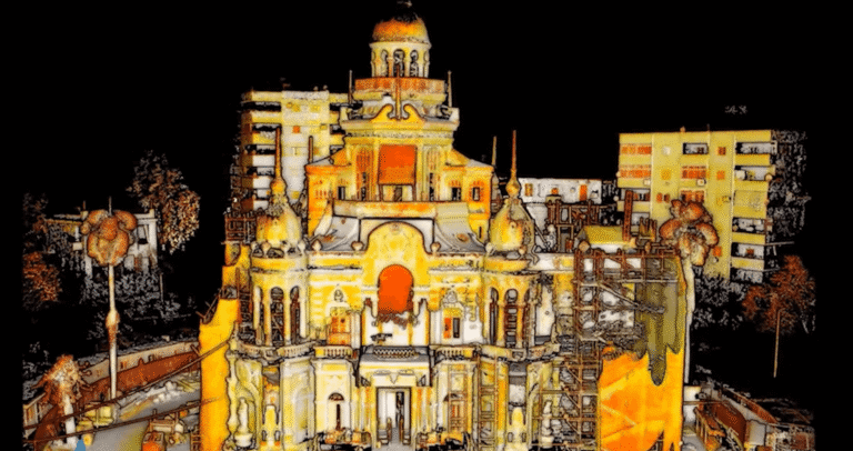
When Emesent had the opportunity to visit El Sakakini Palace, one of Cairo’s most iconic and ornate architectural structures, we captured it in 3D with a single walking scan. Our handheld Hovermap rapidly captured high-quality data within a complex environment.
Join Emesent and Reflektar for this webinar and learn how Reflektar’s AI technology and Cloud-Based GIS Platform could help you realize the full potential of your point clouds.
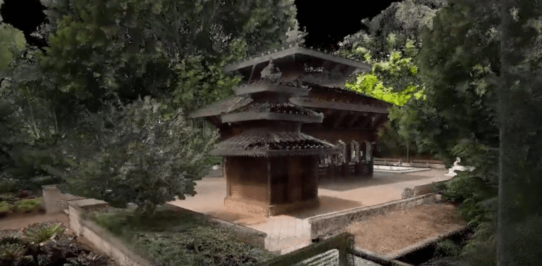
Download the dataset produced during this gorgeous scan of the Nepalese Peace Pagoda in Brisbane. It took just 20 minutes to capture via a backpack walking scan. The scan was processed, colorized, and rendered in the latest version of Emesent’s visualization software, Aura.