-
Open-Pit Mine Mapping on Demand
Fast, precise open-pit mine survey with vehicle-mounted scanning
-
Rapid, accurate vehicle mounted data capture
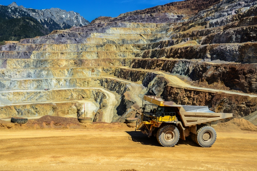
Safety risks from unstable slopes, hazardous working conditions, and steep or inaccessible terrains provide significant operational challenges in open pit mining. Managing these challenges is critical to ensuring safe, efficient, and sustainable mining practices. This makes the ability to safely and efficiently capture accurate, detailed mine site data crucial.
Emesent’s Vehicle RTK solution allows rapid, accurate data capture on demand, simply by driving the area you need to scan. This minimizes disruption while ensuring up-to-the-minute data is always available for informed decision-making.
Terrestrial laser scanning (TLS), while highly accurate, is a slow and labor-intensive process. It requires multiple setups across various locations to ensure comprehensive data capture. Moreover, mines are dynamic environments where frequent changes, such as excavation and blasting, make consistent monitoring a challenge. Delays in data collection can result in operational inefficiencies, costly downtime, and deviations from planned mining activities. Drone-based surveys offer a faster alternative, enabling rapid data collection. However, many drones rely on photogrammetry, which depends on adequate lighting conditions. Drone operation can be restricted by regulations and also constrained by weather conditions.
-
The Emesent Solution
Emesent Vehicle RTK is an advanced data capture solution for confident, large-scale outdoor scanning – delivering rapid, globally accurate results when ground targets are not feasible. It enables rapid and precise 3D data capture, anytime, anywhere, regardless of lighting or weather conditions. With the simple attachment of Hovermap to your vehicle via the custom built mount and a quick connection setup with the RTK base station and receiver, scanning can begin immediately by driving the area – capturing data in one continuous 360 degree scan. Additional context can be added with 360 degree images.
Minimal training is required, making it accessible for anyone to use. For instance, the night shift can be trained to collect data on what has been mined overnight, providing surveyors with up-to-date information by morning. Or geotechnical engineers can capture valuable data at the same time as they drive around the site doing inspections—streamlining operations and improving efficiency.
Automatic drift correction delivers higher quality results for repeat scans over the same area and enables changes to be easily detected. During processing Aura intelligently leverages a combination of RTK and SLAM reference data depending on which has the best position quality to optimize results.
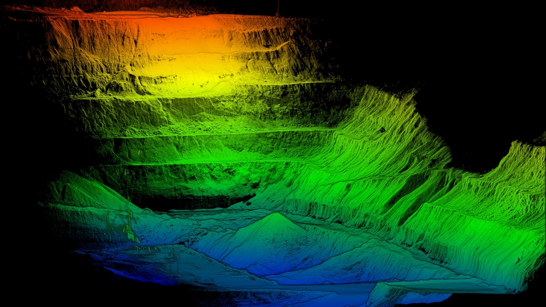
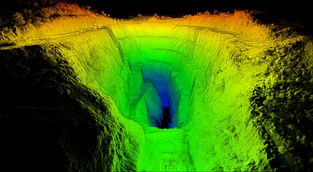
Vehicle RTK is an ideal solution for mapping pits, production areas, stockpiles, blast patterns, mining faces, monitoring catch benches and more.
The versatility of Hovermap means that in areas inaccessible for a vehicle, Emesent’s Backpack RTK allows the same device to be used on a backpack, to simply walk the area to be scanned. Incident surveys could be easily captured using Backpack RTK in one continuous scan while also capturing 360 images of the scene. Hovermap can also be mounted to a drone for rapid, wide area capture.
-
Rapid data capture on demand
Simply attach Hovermap to the vehicle and drive the area.
-
Enhanced accuracy
Automated georeferencing and drift correction enhance accuracy, with results further optimized using an intelligent combination of RTK and SLAM for the most reliable and robust point cloud.
-
Ease of repeatability
Consistent geolocation delivers higher quality results for repeat scans over the same area.
-
No scanning expertise required
Its simple operation requires minimal training, enabling regular scanning to be performed by anyone in the team.
-
Versatile deployment
The same device can be used on multiple platforms including mounted to a vehicle or on a backpack, for data capture in diverse environments.
-
Add additional context
Enhance your point cloud with 360 degree images for greater context.
-
-
Operational workflow
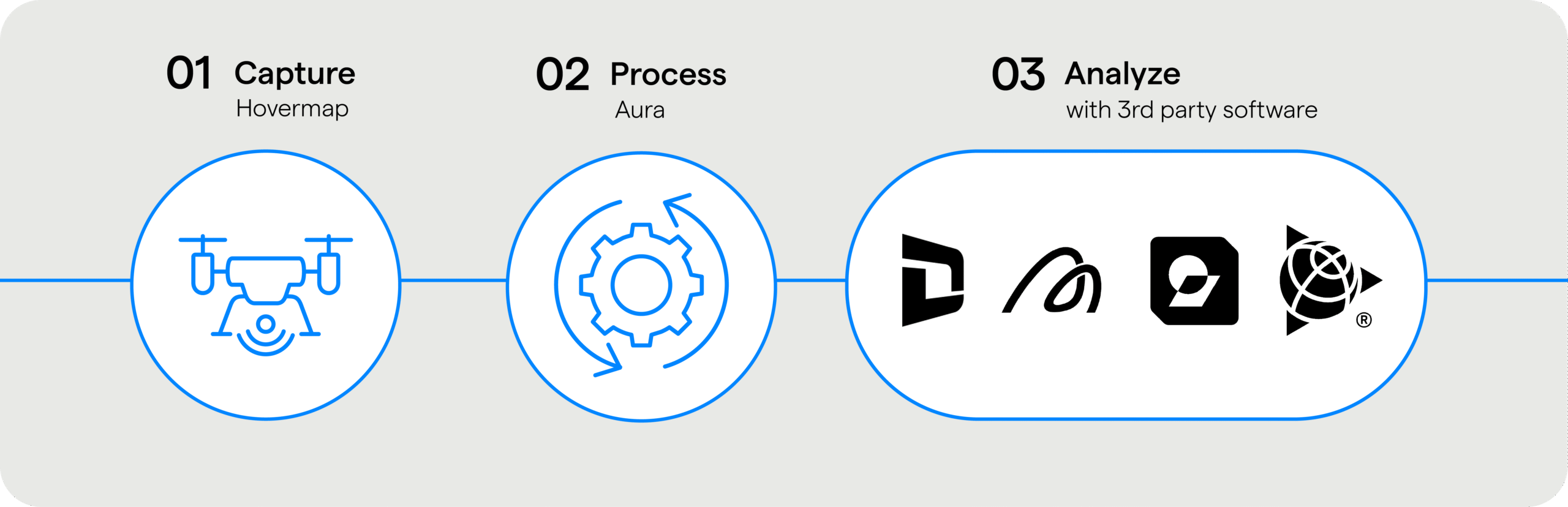
- Deploy Hovermap on a drone, vehicle or handheld depending on pit size and environment.
- Process and automatically georeference your dataset in Aura.
- Easily export into 3rd party tools for volume calculations: Deswik, Maptek, Micromine, Trimble Business Center.
-
Continuous scanning on demand
Vehicle RTK eliminates the need for ground control points, saving time and minimizing disruption to operations.
-
World leading SLAM
Proven reliability in challenging environments where other SLAM systems fail
-

Automated georeferencing and drift correction
Automatically selects the best reference data between RTK and SLAM to optimize results
-
360 degree capture
Capture insights in all directions
-
Real time visualization
Preview the point cloud as you scan to ensure complete data capture
-

Versatile deployment
Single Hovermap device is easily switched between multiple deployment platforms
-
-
Want to see more?
Enquire Now
