
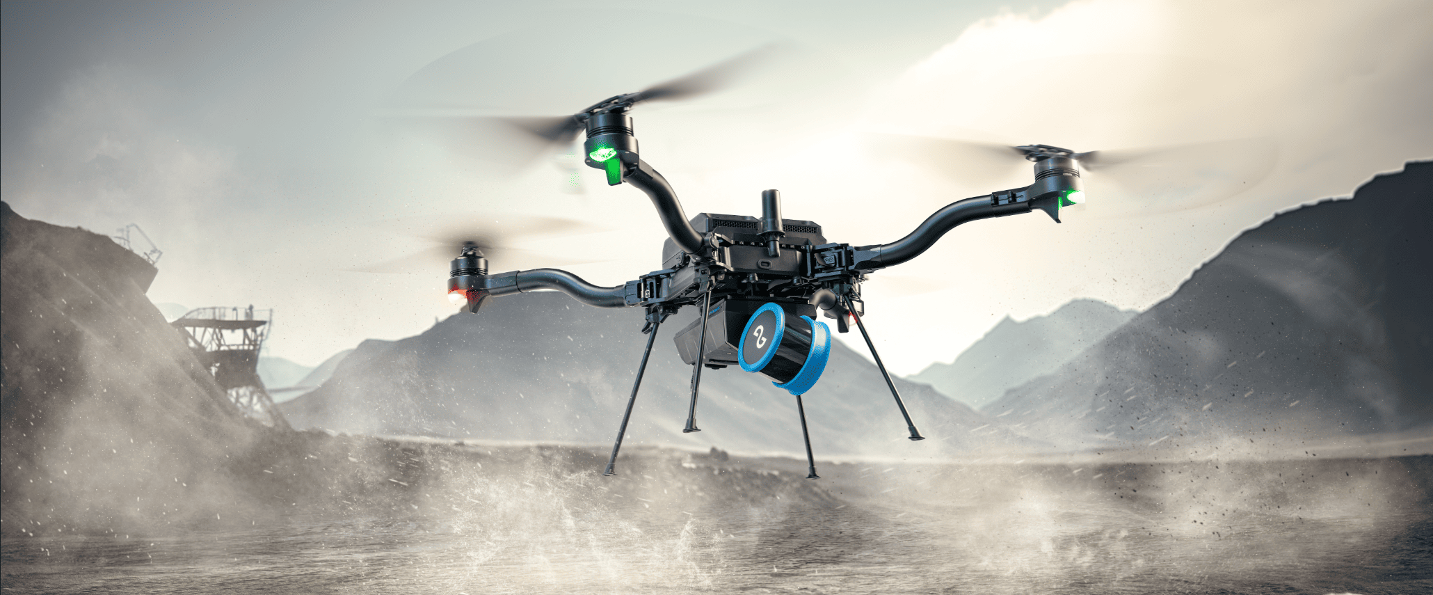
Emesent, the Australian makers of the award-winning Hovermap LiDAR mapping and autonomy payload, have responded to US regulations banning Chinese drones by announcing support for the American made Freefly Astro drone.
Integration with the Astro drone offers Emesent clients – especially those in countries where government restrictions on Chinese drones reduce choice in technology platforms – with a new option for airborne survey missions.
“We’re extremely excited by the performance of the Astro platform, and keen to see how Emesent Hovermap users leverage the combination of Emesent technology and the Astro drone’s capabilities,” said Emesent co-founder and Chief Strategy Officer Dr Stefan Hrabar. “The latest release of our mission planning app Commander, and newly enhanced Hovermap Autonomy, will offer pilots an even easier and stress-free approach to 3D LiDAR mapping in challenging environments.”
“Professional clients have depended on Freefly Systems for the most reliable technology products for over a decade. Our goal is to create the world’s most productive drone ecosystem. Tight integration of the Emesent Hovermap on Astro raises the bar again, providing unmatched autonomy and mapping capabilities even in the most challenging environments,” said Matt Isenbarger, CRO, Freefly Systems.
Designed for physically challenging and GPS-denied environments, Emesent Hovermap captures survey-grade data, quickly and safely, providing surveyors with a high-definition 3D scan of the environment.
The insightful 3D visualizations generated from Hovermap scans enable critical decisions that impact the safety and continuity of business operations across high-risk industries such as mining, construction and public safety.
In addition to drone-based deployment, the platform-agnostic Emesent Hovermap is designed to be deployed on the Boston Dynamics Spot robot, attached to vehicles, or operated as a handheld or backpack mounted scanner. This versatility allows 3D LiDAR mapping of almost any environment.
Emesent’s premium scanning model, the Hovermap ST-X, will be on display during the Geo Week exhibition at Booth #735, Colorado Convention Center, showcasing support for the Astro drone and other deployment options.
*
About Emesent: Emesent is a global leader in autonomous mapping technology, providing an innovative 3D data capture, processing and visualization solution for industries such as mining, public safety, oil and gas, construction, and engineering. Their flagship product Hovermap enables organizations to capture 3D LiDAR data quickly, efficiently, and safely in challenging and time-sensitive environments. Emesent’s products are used by clients worldwide to enhance productivity and decision-making. Established in 2018, Emesent was founded by Dr Stefan Hrabar and Dr Farid Kendoul, following a decade of robotics research at Australia’s CSIRO.
For a one-on-one meeting during Geo Week, book here.
More information about Hovermap can be found on the Emesent website.
Client case studies are available on the Emesent website.
For media related questions please select Contact the Marketing Team when you submit an enquiry.