Emesent offers a faster, more reliable way to capture LiDAR scans over vast areas, releasing a new Hovermap Vehicle Mount with RTK
Emesent’s RTK-based georeferencing and drift correction reduces the need for ground control targets, accelerating time to insight.
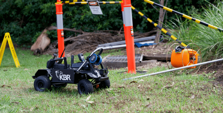
Emesent, a global leader in autonomous digital mapping, has launched a hardware kit and software update enabling vehicle-based LiDAR scanning leveraging real-time kinematics (RTK) GPS.
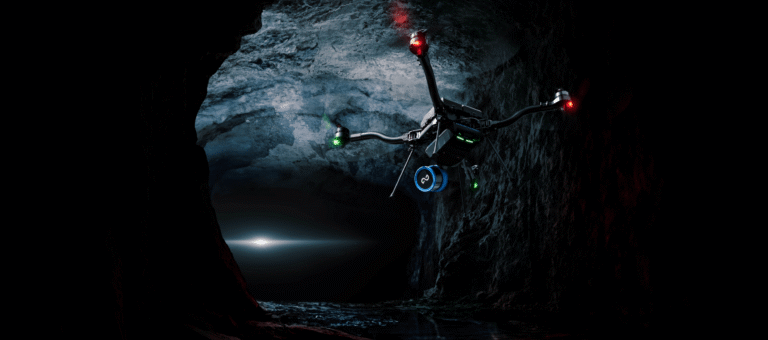
Capturing and georeferencing LiDAR scans over large areas – such as roadways, above-ground mining sites, or places where drones cannot be flown – is time consuming, labor-intensive and costly. Emesent’s vehicle-based scanning with RTK addresses these concerns by reducing or eliminating the need for the deployment of ground control points (GCPs).
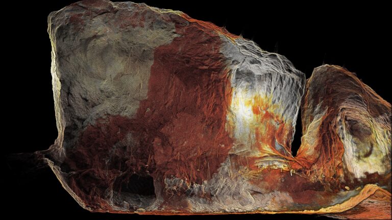
Emesent’s automated georeferencing and drift correction intelligently leverages both RTK and advanced SLAM technology to optimize results and ensure the most accurate point clouds while eliminating error-prone processes.

Users simply attach Emesent’s Hovermap scanning unit and mount to a vehicle, establish a connection to an Emlid RS2/RS2+ GNSS Receiver, and start scanning.
“Emesent’s Vehicle RTK kit reduces reliance on GCPs and increases efficiency in the field,” said Emesent co-founder and Chief Strategy Officer Dr Stefan Hrabar. “Traditional Mobile Mapping Systems that rely purely on GPS/INS can struggle in built-up urban areas where GPS signals are weak. We combine the best of SLAM and RTK GPS to overcome this, allowing downtown areas to be mapped quickly and accurately.”
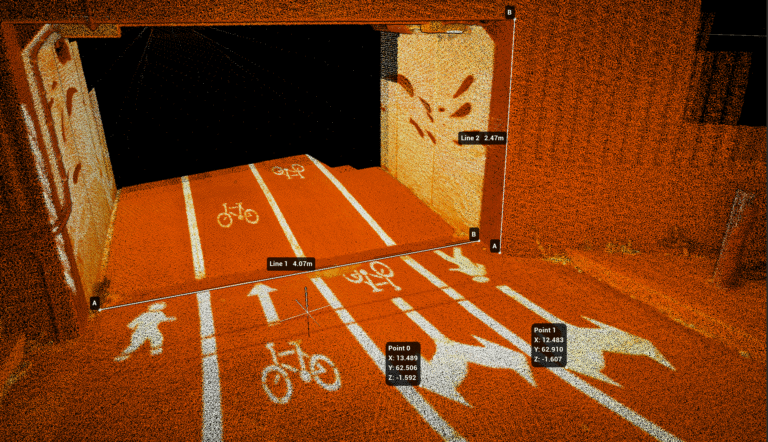
The Vehicle RTK kit is also compatible with Emesent’s 360 panoramic camera add-on for Hovermap, enabling colorization of the point cloud and generation of geo-referenced 360-degree images. This combination enables the capture of LiDAR data and panoramic images which can be imported into 3rd party platforms.
The new kit delivers on Emesent’s renowned versatility, allowing Hovermap to quickly switch between a vehicle, drone, backpack, or handheld scanning.
“Scanning of large areas and long, linear assets have previously been challenging for SLAM-based LiDAR mapping systems,” said Dr Hrabar, “But the Hovermap Vehicle Mount with RTK, combined with our enhanced SLAM, delivers excellent results with minimum effort.”
The launch of the vehicle mount coincides with the latest release of Emesent’s data processing and visualization software Aura.
To learn more about Hovermap, Aura, and the Hovermap Vehicle Mount with RTK visit the Emesent’s website.
Emesent Aura v1.6 is available now for new and existing customers via the Customer Portal on the Emesent website. For a demonstration of Vehicle RTK or Emesent Aura please book a demo.
For media related questions please select Contact the Marketing Team when you submit an enquiry.
Related Resources