AI-powered autonomous mapping
Fully autonomous mapping for challenging environments
Emesent Hovermap’s advanced algorithms combine autonomy, SLAM and LiDAR technologies to deliver smart AI-driven navigation and survey grade results.
Offering proven reliability and rapid data acquisition, Hovermap’s autonomy, powered by Emesent Cortex, enables fully autonomous missions beyond visual line of sight and communication range.
Featuring capabilities such as Omnidirectional Collision Avoidance, position hold, and intelligent Return-to-Home, Hovermap keeps equipment and personnel safe, even in GPS-denied, hazardous, and dark environments. Entire flights can be managed via tablet, with real-time point cloud streaming and onboard processing that accelerates analysis and decision-making.
Let Hovermap’s AI-powered autonomy take control
Proven reliability
Rigorously tested and continuously enhanced for robustness in tough environments, Emesent’s state-of-the-art SLAM, and cutting-edge autonomy algorithms deliver exceptional reliability and performance.
Operate beyond line-of-sight and communications range
AI-powered autonomous navigation enables deployment beyond communications range and visual line of sight with no additional infrastructure required, with or without GPS.
Omnidirectional collision
avoidance
Advanced perception minimizes the required distance from obstacles, allowing safer autonomous movement, even in tight spaces.
Choice of operating modes
Choose your mode – pilot assist, autonomous waypoint or autonomous exploration – depending on the task, environment, and desired balance between human oversight and efficiency.
Advanced failsafes
Advanced failsafes and behaviors deal with challenging conditions such as dust, thin wires, and communication loss. Smart Return-to-Home finds the quickest way for the drone to return home.
Pilot expertise not required
Intuitive operation without the need to be an expert drone pilot, making advanced exploration accessible to the whole team.
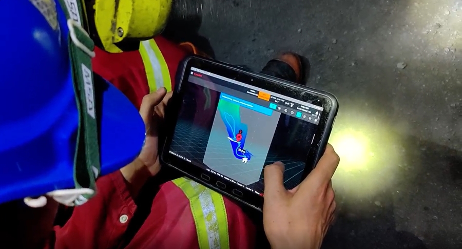
Livestreamed point cloud
Hovermap pilots can fly an entire mission, from take-off to landing, from a tablet. Data is processed onboard in real-time, and a 3D map streamed back to the operator.
Plug and play across multiple platforms
Emesent’s autonomy system auto-detects the platform and configures itself for optimal performance.
Onboard processing
Streamlined outputs deliver instant insights, while optimizing data for rapid network transfer and ease of manipulation in 3rd party tools for further analysis.
See Hovermap autonomy in action
The Autonomy Solution
The Hovermap Autonomy Solution enables deployment beyond visual line of sight (BVLOS) and communications range and provides advanced BVLOS waypoint-based mission planning and enhanced Return-to-Home functionality. Hovermap pilots can fly an entire mission, from takeoff to landing, using a tablet. Data is processed onboard in real-time, and a 3D map streamed back to the operator. The Autonomy Solution is suited for data capture of complex assets in challenging, GPS-denied environments in infrastructure, construction, engineering, energy, and underground mining.

Advanced Failsafes

Tap-to-fly operation

Omnidirectional collision avoidance

GPS-Denied Flight

Greater insights
visualization.

Integrated workflows
Further reading

Stope Scanning
At Barrick’s Bulyanhulu and Kibali sites, surveyors were unable to obtain accurate and complete production data using the traditional pole-mounted CMS scanning method, particularly in larger, more inaccessible stopes.

Mapping a Sinkhole
When a dangerous sinkhole the size of half a tennis court suddenly appeared at a popular tourist location on the Robe coastline, the council looked to a leading provider of spatial data services, Veris, to safely capture the data needed for accurate decision-making.