Skip to content
Emesent
  • ProductsExpand
    • Payloads
      • Hovermap
      Software
      • Aura
      • Commander
      • Cortex
      Accessories
      • 360° Image Kit
      • Backpack RTK
      • CMS Mount
      • Drone RTK
      • Hovermap LHD
      • Vehicle
 RTK
      Extensions
      • 360° Colorization
      • Automated Ground 
Control
      • Long Range Radio
      Robotics platforms
      • Boston Dynamics Spot robot
      • DJI M350 drone
      • Freefly Astro Max drone
      Ready to see how Emesent products work?​
      Get in touch
  • SolutionsExpand
    • Mining
      • Convergence Monitoring
      • Open Pit Mine Mapping
      • Stockpile Measurement
      • Stope Reconciliation
      • Underground Mine Production
      AEC
      • Construction As-built Survey
      • Infrastructure As-built Survey
      • Routine Bridge Inspection
      • Topographic Survey
      Industry use cases
      • AEC
      • Defense
      • Geospatial
      • Mining
      • Oil and Gas
      • Public Safety
      Third-party software workflows
      • For AEC
      • For Mining
      Ready to see how Emesent products work?​
      Get in touch
      Mining
      • Convergence Monitoring
      • Underground Mine Production
      AEC
      • Construction As-built Survey
      • Topographic Survey
      Industry use cases
      • AEC
      • Geospatial
      • Mining
      • Oil and Gas
      • Public Safety
      Ready to see how Emesent products work?​
      Get in touch
      Featured Case Study

      Leveraging 3D data for decision-making in public safety

      Read more
  • ResourcesExpand
      • ALL Resources
      • Blog
      • Case studies
      • Datasets
      • Events
      • News
      • Videos
      • Webinars
      • Client portal
      • Knowledge base
      • Partner portal
      • Client experience
      Ready to see how Emesent products work?​
      Get in touch
      Featured Content

      Hovermap Accuracy Report

      Read more

  • AboutExpand
      • Our team
      • Careers
      • Contact
      Emesent’s strengths
      • Mapping
      • Autonomy
      • Versatility
      Ready to see how Emesent products work?​
      Get in touch
  • BuyExpand
      • Book a Demo
      • Find a Reseller
      • Request Pricing
      • Explore Business Plans
      • Visit Emesent Store
      Offers
      • Hovermap 100 offer
      • Autonomy discount
      Ready to see how Emesent products work?​
      Get in touch
Client Portal
Partner Portal
Account
Talk to a Specialist

Emesent
Customer Portal
Partner Portal

Environmental

From Hospital to Forest: Unlocking deeper insights through faster reality capture
Webinars

From Hospital to Forest: Unlocking deeper insights through faster reality capture

ByKatie Koss July 28, 2025September 16, 2025

Hovermap users BIM Manufacture share 3 real-world projects showcasing the speed, flexibility, and accuracy of Emesent Hovermap and hybrid scanning techniques.
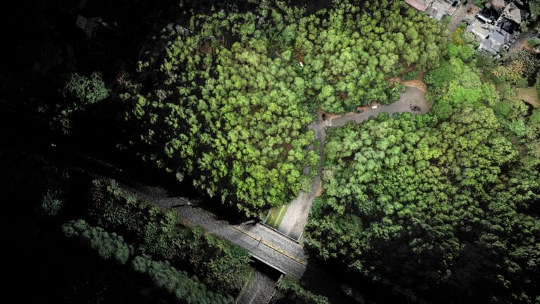
Read More From Hospital to Forest: Unlocking deeper insights through faster reality captureContinue

Nature’s Point Clouds – Outdoor adventures with Emesent Hovermap
Webinars

Nature’s Point Clouds – Outdoor adventures with Emesent Hovermap

ByKatie Koss July 8, 2025August 1, 2025

AirborneLogic presents case studies on how they use the Emesent Hovermap ST-X to accurately measure trees, carbon and biodiversity in an effort to quantify natural capital and help regenerate our environment.

Read More Nature’s Point Clouds – Outdoor adventures with Emesent HovermapContinue

Unlock the Power of Precision Mapping: Emesent Hovermap Backpack RTK
Webinars

Unlock the Power of Precision Mapping: Emesent Hovermap Backpack RTK

ByKatie Koss February 3, 2025August 1, 2025

Join us for an exclusive deep dive into the revolutionary Emesent Hovermap RTK Backpack—a game-changing tool for high-accuracy LiDAR mapping.

Read More Unlock the Power of Precision Mapping: Emesent Hovermap Backpack RTKContinue

Accelerate Traditional Surveying and Mapping with Emesent Hovermap
Webinars

Accelerate Traditional Surveying and Mapping with Emesent Hovermap

ByKatie Koss September 27, 2024August 1, 2025

Join Lin Trading and discover how Hovermap’s cutting-edge LiDAR technology accelerates the production of CAD drawings and BIM models, making traditional surveying work faster and more accurate.

Read More Accelerate Traditional Surveying and Mapping with Emesent HovermapContinue

Approaching JC Slaughter Falls trail – Brisbane, Australia
Videos

Approaching JC Slaughter Falls trail – Brisbane, Australia

ByKatie Koss September 15, 2024October 22, 2024

Read More Approaching JC Slaughter Falls trail – Brisbane, AustraliaContinue

Hovermap – Beyond just drone-based scanning
Webinars

Hovermap – Beyond just drone-based scanning

ByKatie Koss August 13, 2024August 1, 2025

Unlock the full potential of Emesent’s Hovermap system in our webinar, “Hovermap – Beyond just drone based scanning,” presented by Matt MacKinnon, the pioneering Founder and Technical Operations Manager of Unmanned Aerial Services Inc.

Read More Hovermap – Beyond just drone-based scanningContinue

Mapping a Sinkhole and Hazardous Coastal Areas Safely
Webinars

Mapping a Sinkhole and Hazardous Coastal Areas Safely

ByJulia Marteau-Reay February 2, 2023August 1, 2025

When a  dangerous sinkhole the size of half a tennis court suddenly appeared at a popular tourist location on the Robe coastline, the council looked to a leading provider of spatial data services, Veris, to safely capture the data needed for accurate decision-making.

Read More Mapping a Sinkhole and Hazardous Coastal Areas SafelyContinue

Hovermap For Forestry
Webinars

Hovermap For Forestry

ByJulia Marteau-Reay September 26, 2022August 1, 2025

Find out how Hovermap solves the problem of data capture in challenging under canopy forestry environments

Read More Hovermap For ForestryContinue

Truckee River Flume – LiDAR vs Photogrammetry
Videos

Truckee River Flume – LiDAR vs Photogrammetry

ByKatie Koss February 2, 2022October 10, 2024

Read More Truckee River Flume – LiDAR vs PhotogrammetryContinue

From Point Clouds to CAD Drawings
Webinars

From Point Clouds to CAD Drawings

BySaad Support November 26, 2021August 1, 2025

Producing better outputs, faster with Hovermap data in PointCab Origins

Read More From Point Clouds to CAD DrawingsContinue

Page navigation

1 2 Next PageNext
Emesent delivers high quality data capture to provide revolutionary efficiency, safety, and operational insights.
About our products
  • Hovermap
  • Aura
  • Commander
  • Book a Demo
  • Request Pricing
  • Business Plans
About our technology
  • Mapping
  • Autonomy
  • Versatility
Info & Resources
  • News & client stories
  • Client Portal
  • Where to buy
  • Partner Portal
  • Partner with us
About our business
  • Contact us
  • About Emesent
  • Careers
  • Privacy Policy
  • Quality Policy

Copyright © 2025 Emesent. All rights reserved.

  • Products
    • Payloads
      • Hovermap
      Software
      • Aura
      • Commander
      • Cortex
      Accessories
      • 360° Image Kit
      • Backpack RTK
      • CMS Mount
      • Drone RTK
      • Hovermap LHD
      • Vehicle
 RTK
      Extensions
      • 360° Colorization
      • Automated Ground 
Control
      • Long Range Radio
      Robotics platforms
      • Boston Dynamics Spot robot
      • DJI M350 drone
      • Freefly Astro Max drone
      Ready to see how Emesent products work?​
      Get in touch
  • Solutions
    • Mining
      • Convergence Monitoring
      • Open Pit Mine Mapping
      • Stockpile Measurement
      • Stope Reconciliation
      • Underground Mine Production
      AEC
      • Construction As-built Survey
      • Infrastructure As-built Survey
      • Routine Bridge Inspection
      • Topographic Survey
      Industry use cases
      • AEC
      • Defense
      • Geospatial
      • Mining
      • Oil and Gas
      • Public Safety
      Third-party software workflows
      • For AEC
      • For Mining
      Ready to see how Emesent products work?​
      Get in touch
      Mining
      • Convergence Monitoring
      • Underground Mine Production
      AEC
      • Construction As-built Survey
      • Topographic Survey
      Industry use cases
      • AEC
      • Geospatial
      • Mining
      • Oil and Gas
      • Public Safety
      Ready to see how Emesent products work?​
      Get in touch
      Featured Case Study

      Leveraging 3D data for decision-making in public safety

      Read more
  • Resources
      • ALL Resources
      • Blog
      • Case studies
      • Datasets
      • Events
      • News
      • Videos
      • Webinars
      • Client portal
      • Knowledge base
      • Partner portal
      • Client experience
      Ready to see how Emesent products work?​
      Get in touch
      Featured Content

      Hovermap Accuracy Report

      Read more

  • About
      • Our team
      • Careers
      • Contact
      Emesent’s strengths
      • Mapping
      • Autonomy
      • Versatility
      Ready to see how Emesent products work?​
      Get in touch
  • Buy
      • Book a Demo
      • Find a Reseller
      • Request Pricing
      • Explore Business Plans
      • Visit Emesent Store
      Offers
      • Hovermap 100 offer
      • Autonomy discount
      Ready to see how Emesent products work?​
      Get in touch
  • Customer Portal
  • Partner Portal

  • Español
  • 日本語
  • Português
  • 中文 (简体)

Book a Demo
Search