Emesent Accuracy Report
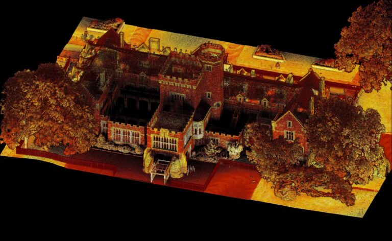
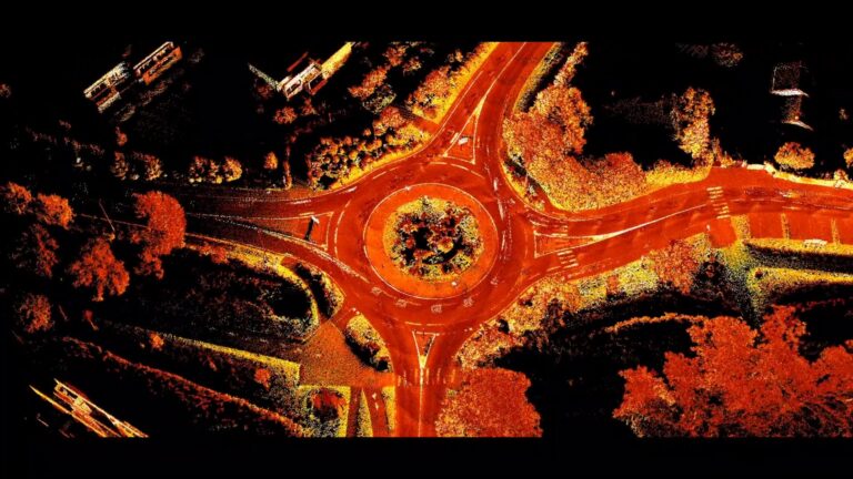
Verified by independent surveyor Orion Spatial Solutions, this August 2025 report tests the accuracy of Emesent Hovermap using control points. Download the report to see the full results.

Verified by independent surveyor Orion Spatial Solutions, this August 2025 report tests the accuracy of Emesent Hovermap using control points. Download the report to see the full results.
Join Emesent and Technology Support Services as they share real-world examples of how SLAM-based scanning streamlines site assessments, infrastructure modeling, design validation, and the creation of digital twins.
Join Dr. Thibault Rouillard, founder of Clarity Consulting Limited, as he shares how his team use Emesent Hovermap to capture and transform data across a wide range of projects. From detailed building surveys and topographic mapping, to volume measurement and landscape design.
Emesent and UAS present this gripping case study on how an autonomous Hovermap exploration mission was launched underground to achieve complete 3D mapping for emergency response in just 48 hours.
Join Emesent and Mangoesmapping for an online session showcasing how RTK-enabled LiDAR and GNSS are transforming infrastructure and construction projects. We’ll highlight how Australian teams are adopting Emesent Hovermap systems with Emlid GNSS receivers to capture accurate data, streamline workflows, and reduce project costs.

Hovermap users BIM Manufacture share 3 real-world projects showcasing the speed, flexibility, and accuracy of Emesent Hovermap and hybrid scanning techniques.
In this practical webinar, Emesent partner EscaDrone share their expertise in using Hovermap ST-X for road survey project. Learn about the benefits and understand the workflow for surveyors in the field.
Emesent, a global leader in autonomous digital mapping, will appear at Geo Connect Asia 2025 at the Sands Expo and Convention Centre Singapore, focussing on the versatility and accuracy of its mobile data capture and visualization solutions for geospatial and AEC.
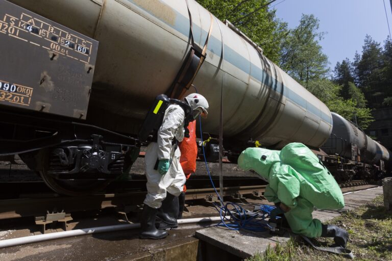
Hovermap capability delivers immediate visibility that supports and
accelerates CBRNE and Hazmat incident management decision-making, whilst reducing risk to personnel.

Join us for an exclusive deep dive into the revolutionary Emesent Hovermap RTK Backpack—a game-changing tool for high-accuracy LiDAR mapping.