Emesent enables safer 3D mapping with more powerful autonomous perception capabilities for drone missions in GPS-denied locations
New Commander tablet app combined with Emesent Autonomy technology supports easier LiDAR mapping missions in dangerous and inaccessible environments
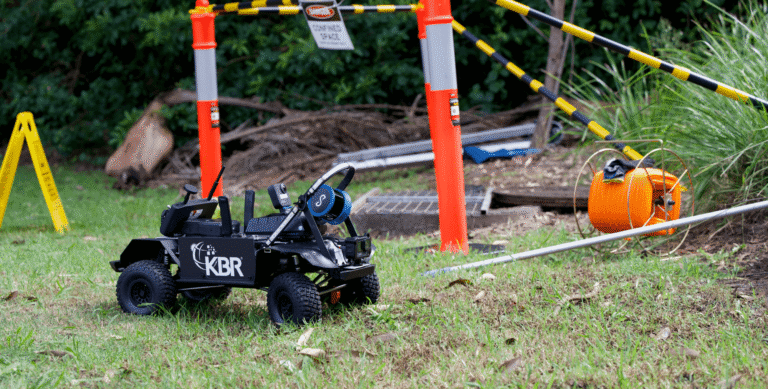
Emesent, a global leader in autonomous mapping of challenging environments, has released upgraded autonomy technology that provides the smarts for safer mapping missions. At the same time, Emesent has launched a new tablet app – Commander – for its award-winning SLAM-based Hovermap LiDAR mapping system that leverages Emesent’s new autonomous capabilities.
Emesent Commander incorporates a completely redesigned interface and offers major improvements to the software’s usability and simplicity, including more responsive visualization of captured data, ensuring missions are safer, more efficient and easier to complete.
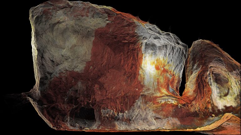
“Hovermap is renowned for its ability to capture high-resolution point clouds in challenging GPS-denied environments,” said Emesent CEO and co-founder Stefan Hrabar. “This powerful combination of Commander with our new Autonomy release now allows clients to use Hovermap in ways and spaces that weren’t possible before.”
Re-architected from the ground up, Commander takes the user experience to new heights, improving performance and speed for simpler, smoother missions. Pre-mission checklists provide important reminders, while informative screen prompts give operators actionable steps for remediation, dramatically enhancing safety and offering greater protection of personnel throughout the entire data capture process.
Emesent’s latest update to its Autonomy technology includes improvements to the perception pipeline, making it possible to detect smaller obstacles from further away, plan mission paths in a safer way, and filter dust in real time.
Meanwhile, changes to the state estimation algorithm now seamlessly combine GPS or SLAM when GPS is available, making it significantly more reliable and robust to fly a drone passing in and out of GPS reception. As a result, pilots no longer need to think about the environment they are operating in, allowing them to simply focus on their mission.
“With Commander, you’ll notice things load quicker, the app is more responsive, and the user interface elements are highly interactive. When using Hovermap for an autonomous mission, we’ve also made it easier to set up tasks for that mission.”
The capabilities of Commander and the new Autonomy release include:
- Enhanced perception for superior obstacle avoidance and advanced navigation for optimal data capture and operations.
- A simplified, intuitive and highly responsive touchscreen interface.
- A streamlined mission workflow for both mapping and autonomous missions.
- Safer mission deployment with clear warnings and notifications to keep missions on track.
- Optimized point-cloud handling.
To learn more about Commander and its features, visit Emesent’s website.
About Emesent: Emesent is a global leader in autonomous mapping technology, providing an innovative 3D data capture, processing and visualization solution for industries such as mining, public safety, oil and gas, construction, and engineering. Award-winning flag-ship product Hovermap enables organizations to capture 3D LiDAR data quickly, efficiently, and safely in challenging and time-sensitive environments. Emesent’s products are used by clients worldwide to enhance productivity and decision-making. Established in 2018, Emesent was founded by Dr Stefan Hrabar and Dr Farid Kendoul, following a decade of robotics research at Australia’s CSIRO.
Client case studies are available on the Emesent website.
For media inquiries, please contact:
Stuart Hill c/o: marketing@emesent.io
Related Resources