Emesent launches Backpack RTK solution for Hovermap, unlocking more versatility and accurate SLAM scanning
Backpack RTK expands Emesent’s versatile range of RTK GPS enabled Hovermap solutions to allow accurate data capture in even more environments
Emesent, a global leader in autonomous digital mapping, has released its Backpack RTK mapping solution on the eve of the INTERGEO 2024 Expo and Conference. This expands the range of real-time kinematics (RTK) GPS-enabled deployment options for the Emesent Hovermap scanner.
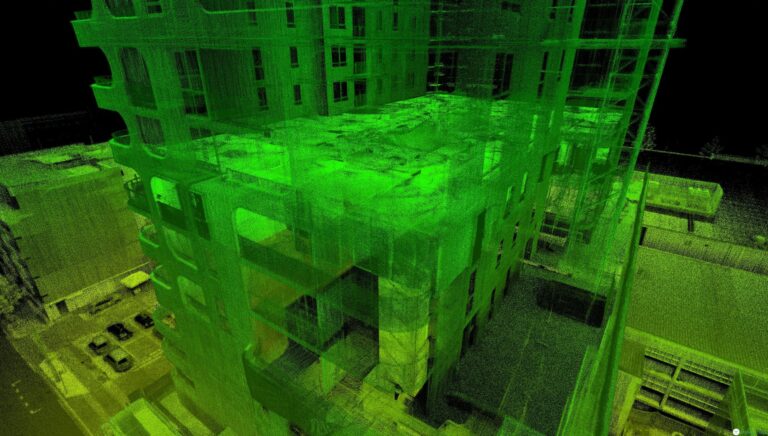
Hovermap is a SLAM-based mapping solution known for its versatility and data quality. Emesent previously released both Vehicle RTK and Drone RTK integration solutions for Hovermap, enabling accurate and efficient mapping of large open areas, long linear assets, streets and tunnels.
The Hovermap Backpack RTK solution complements these by enabling data capture in environments that are better suited to walking-based scans such as narrow streets, forests, yards and building construction sites.
“Emesent’s Backpack RTK Kit will be a time-saver for many field surveyors, by reducing reliance on GCPs while delivering highly accurate and detailed results”
-Dr Stefan Hrabar, Emesent co-founder and Chief Strategy Officer
Emesent’s Aura software intelligently combines the RTK GPS data with SLAM to provide two benefits: it both accurately geo-references the SLAM data and improves accuracy by using the RTK data as a SLAM constraint. It thereby combines the strengths of SLAM and RTK GPS to create accurate, geo-referenced results. Users can automatically reproject and apply a geoid to their Backpack RTK data as part of the processing workflow in Aura, and a geo-referencing accuracy report is generated.
The use of RTK speeds up the data capture process as it removes the need to lay out and geo-reference ground control points.
Users simply unpack the Hovermap and RTK receiver which are safely stored in the backpack for transport, attach these to the backpack, establish a connection to the GNSS Receiver, and start scanning.

“The strength of Emesent’s solution is its ability to intelligently fuse SLAM and RTK data, using the best of both to produce accurate results.”
-Dr Stefan Hrabar, Emesent co-founder and Chief Strategy Officer

“Emesent now offers an extremely versatile, highly accurate scanning solution supporting multiple AEC use cases,” said Dr Hrabar. “Whether you are capturing data for topographical surveys by drone or car, creating smaller-scale maps and construction as-built surveys by walking, Hovermap is the ideal tool to cover these diverse scenarios.”
Backpack RTK also supports Emesent’s 360 image kit for Hovermap, enabling colorization of the point cloud with 360 images or the creation of 360 image virtual tours in platforms such as Cintoo and Pointerra3D.
Emesent currently supports the Emlid RS2/RS2+ range of GNSS receivers for Backpack RTK and Vehicle RTK and will soon support Trimble and other receivers.
Emesent Backpack RTK, Vehicle RTK and Drone RTK are available to order. Emesent’s latest product releases, both software and hardware, and solutions for topographical surveys and construction as-built surveys will be on show at INTERGEO. Attendees can find Emesent at booth F1.0688.
To learn more about Emesent, Hovermap and Backpack RTK visit Emesent’s website.
For a demonstration of Hovermap, Backpack RTK or any of Emesent’s other products, please book a demo.
For media related questions please select Contact the Marketing Team when you submit an enquiry.


