
By Henry Henderson-Genefaas
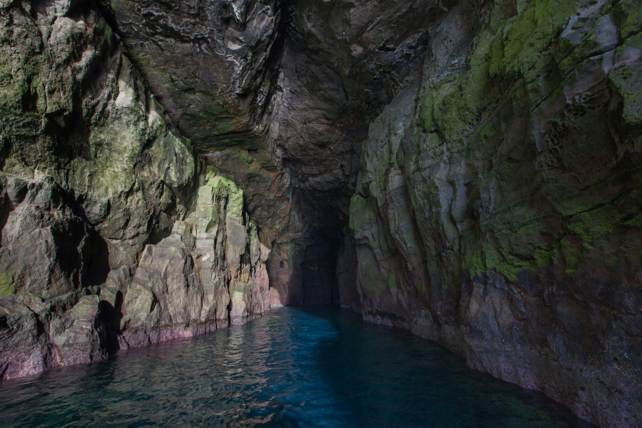
I was recently invited to participate in a once in a lifetime project at a remote island in the Faroe Islands, a place where rugged cliffs meet the wild North Atlantic. The mission? To determine if this hidden marvel could be home to the largest sea cave in the world. Accessible only by boat, the cave features three distinct entrances—two connected by water and the third requiring a trek on foot.
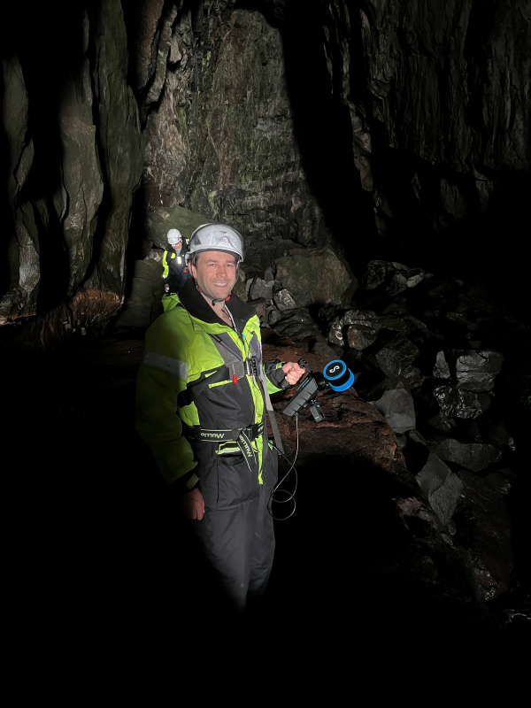
The ability of the Hovermap ST-X SLAM-based LiDAR mapping solution to capture data in GPS denied environments made it an ideal tool to scan in this challenging location. To measure the cave’s volume above the waterline, the team deployed Hovermap as a handheld unit, while the Faroe Islands Hydrographic Survey Department took on the challenge of mapping the submerged sections.
The capture process
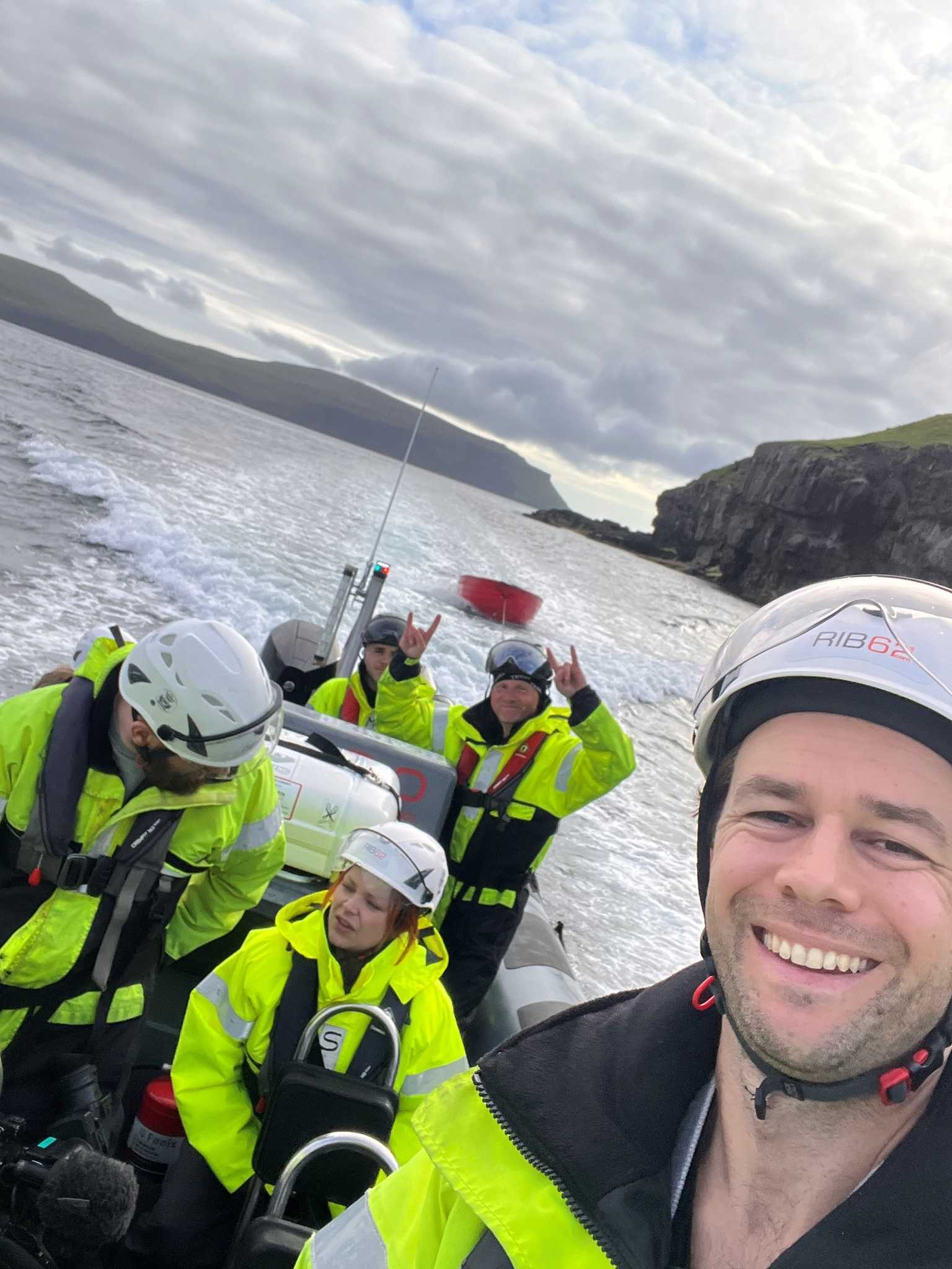
We began by scanning the cave’s entrance while aboard a motor boat. Upon reaching land, we conducted a thorough scan of the area connecting to the cave’s interior, navigating through a narrow section via a small rowboat. After completing this segment, we transferred back onto the larger boat to continue scanning the remaining sections of the cave. Comprehensive coverage was ensured by performing scans in both directions and capturing data along the cave’s face. This enabled us to tie all three entrances together, both internally and externally.
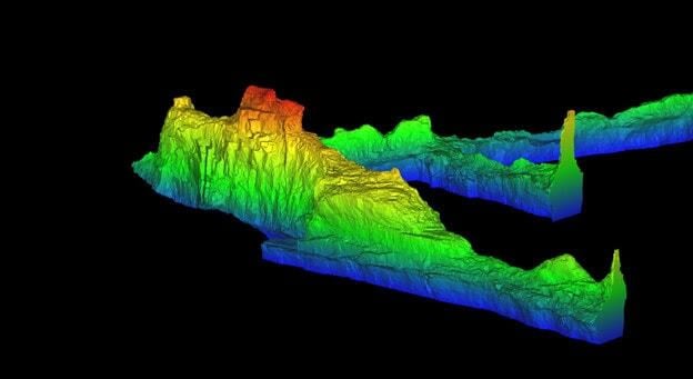
The small form factor of the Hovermap unit and the versatility of being able to use it handheld made it easy to make the boat transfers as well as conduct the walking sections of the scan and ensured we ended up with very complete capture of the caving structure. This meant we could be confident of accurate volumes. Data capture time was around 1.5 hours of the four hour boat expedition. Once the data capture was complete we merged all collected data using Emesent’s Aura processing and visualization software to create a complete and accurate 3D model of the cave system.
The calculations
While conducting the scan, the tide changed by approximately 0.3 meters, which we needed to account for in our volume calculations. By calculating the volume up to the high tide mark, we ensured that any below-water-level components could be accurately measured against the same water level. Then to refine our calculations, we established vertical planes at each cave entrance, ensuring that the volume measured only included the airspace within the cave. LiDAR data points were filtered to a resolution of 0.1 meters and a surface model created to calculate the volume. Based on our analysis, we estimate the volume to be accurate within about 0.25%.
The results
So has the Faroe Islands usurped New Zealand’s position as having the largest sea cave in the world?
The previous record-holder, Rikoriko cave in New Zealand has a total volume (air + water) of 221,500m^3.
In the Faroe Islands, the volume of air alone was calculated at 227,000m^3. Pending confirmation by the Faroe Islands Hydrographic Survey Department, the water volume of 50,000^3 would bring us to 277,000m^3 total volume. So the prediction is yes!