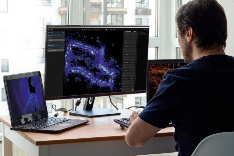
Decision Support for CBRNE and HAZMAT Incident Management
Hovermap capability delivers immediate visibility that supports and
accelerates CBRNE and Hazmat incident management decision-making, whilst reducing risk to personnel.
Hovermap capability delivers immediate visibility that supports and
accelerates CBRNE and Hazmat incident management decision-making, whilst reducing risk to personnel.
In this webinar recording we unveil advancements in Emesent’s autonomous mapping capabilities – powered by the latest release of Emesent Cortex and Emesent’s mission control app Commander. This session showcases how our solutions are bringing stope insights faster, safer, and more efficiently than ever before, enabling even the most challenging, previously impossible missions.
Emesent, the gold standard in SLAM-based mobile reality capture and a global leader in autonomous digital mapping, will demonstrate its breadth of versatile scanning solutions at the upcoming Geo Week event in Denver, Colorado this February.
By drastically improving the efficiency of data capture and the quality of the resulting point clouds, Emesent’s 360 Image Capture and Colorization kits have become essential tools for professionals who need to work quickly without sacrificing accuracy.
Join us for an exclusive deep dive into the revolutionary Emesent Hovermap RTK Backpack—a game-changing tool for high-accuracy LiDAR mapping.
The Department of Special Geodesy at the Czech Technical University in Prague put Emesent Hovermap to the test in a 120 meter long mining tunnel. How did it fare against other scanners, both static and SLAM-based?
Join Emesent partner Dwyka Mining Services and Dwarsrivier Mine as they reveal how Hovermap’s handheld and backpack devices provided precise, real-time data for month-end measurements, plan updates, stockpile tracking, and room and pillar design, boosting productivity and improving decision-making.
This scan of a 500m x 500m open pit mine was captured in just 9 minutes by Emesent Hovermap mounted to a drone. Being able to see the shells of the pit in reality, rather than just from design, helps life-of-mine planning departments when comparing the plan to as-built. The scan was colorized using the…
Join Emesent partner Gestao Engenharia as they explore the methodology behind monitoring convergence of the access gallery at a gold mine.
Download the dataset produced during Emesent’s Backpack RTK accuracy test. Conducted along a 950m stretch of road in Brisbane, Australia, and verified by Orion Spatial Solutions.