Meet Karla Gullon – Client Support Team Lead
Get to know Karla Gullon, Emesent’s Client Support Team Lead, in this Q&A.
Get to know Karla Gullon, Emesent’s Client Support Team Lead, in this Q&A.
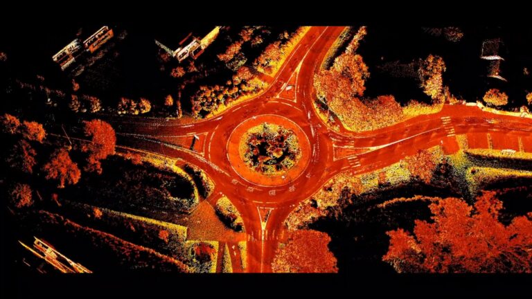
In this practical webinar, Emesent partner EscaDrone share their expertise in using Hovermap ST-X for road survey project. Learn about the benefits and understand the workflow for surveyors in the field.

Emesent, a global leader in autonomous digital mapping, will appear at Geo Connect Asia 2025 at the Sands Expo and Convention Centre Singapore, focussing on the versatility and accuracy of its mobile data capture and visualization solutions for geospatial and AEC.
Get to know Ian Goebel, Emesent’s Client Success Team Lead, in this Q&A.
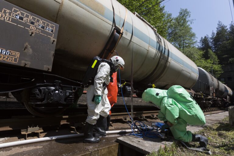
Hovermap capability delivers immediate visibility that supports and
accelerates CBRNE and Hazmat incident management decision-making, whilst reducing risk to personnel.
In this webinar recording we unveil advancements in Emesent’s autonomous mapping capabilities – powered by the latest release of Emesent Cortex and Emesent’s mission control app Commander. This session showcases how our solutions are bringing stope insights faster, safer, and more efficiently than ever before, enabling even the most challenging, previously impossible missions.

Emesent, the gold standard in SLAM-based mobile reality capture and a global leader in autonomous digital mapping, will demonstrate its breadth of versatile scanning solutions at the upcoming Geo Week event in Denver, Colorado this February.

By drastically improving the efficiency of data capture and the quality of the resulting point clouds, Emesent’s 360 Image Capture and Colorization kits have become essential tools for professionals who need to work quickly without sacrificing accuracy.

Join us for an exclusive deep dive into the revolutionary Emesent Hovermap RTK Backpack—a game-changing tool for high-accuracy LiDAR mapping.

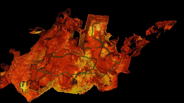
The Department of Special Geodesy at the Czech Technical University in Prague put Emesent Hovermap to the test in a 120 meter long mining tunnel. How did it fare against other scanners, both static and SLAM-based?