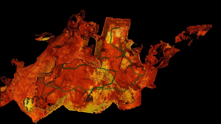
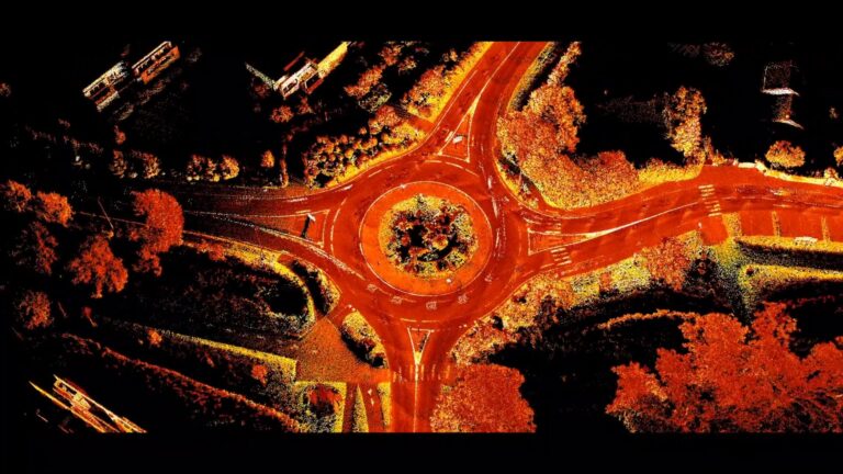
Mapping the Carrapateena mega cave: How Hovermap conquered the inaccessible

Mapping the Carrapateena mega cave: How Hovermap conquered the inaccessible

When a 5m diameter hole appeared at the surface of the Carrapateena copper reserve in 2023 (and continued to grow over the next few months), regular scanning became critical in order to ensure both the safety of mine personnel and the stability of its operations. Read how Emesent’s Hovermap autonomously and safely captured critical data for the site.

Emesent partners with Cintoo to deliver versatile end-to-end reality capture solution

Emesent partners with Cintoo to deliver versatile end-to-end reality capture solution

Hovermap LiDAR point clouds and panoramic images can be easily viewed and shared in high quality across multiple locations through Cintoo’s platform, enhancing communication and interpretation of 3D scan data Emesent, maker of the award-winning Hovermap LiDAR mapping and autonomy solution, has partnered with Cintoo, the leading cloud platform provider for collecting, collaborating, sharing, and managing…

Emesent launches Backpack RTK solution for Hovermap, unlocking more versatility and accurate SLAM scanning

Emesent launches Backpack RTK solution for Hovermap, unlocking more versatility and accurate SLAM scanning

Backpack RTK expands Emesent’s versatile range of RTK GPS enabled Hovermap solutions to allow accurate data capture in even more environments Emesent, a global leader in autonomous digital mapping, has released its Backpack RTK mapping solution on the eve of the INTERGEO 2024 Expo and Conference. This expands the range of real-time kinematics (RTK) GPS-enabled deployment options for…