Georeferencing in Aura with User Selected Targets and Check Points
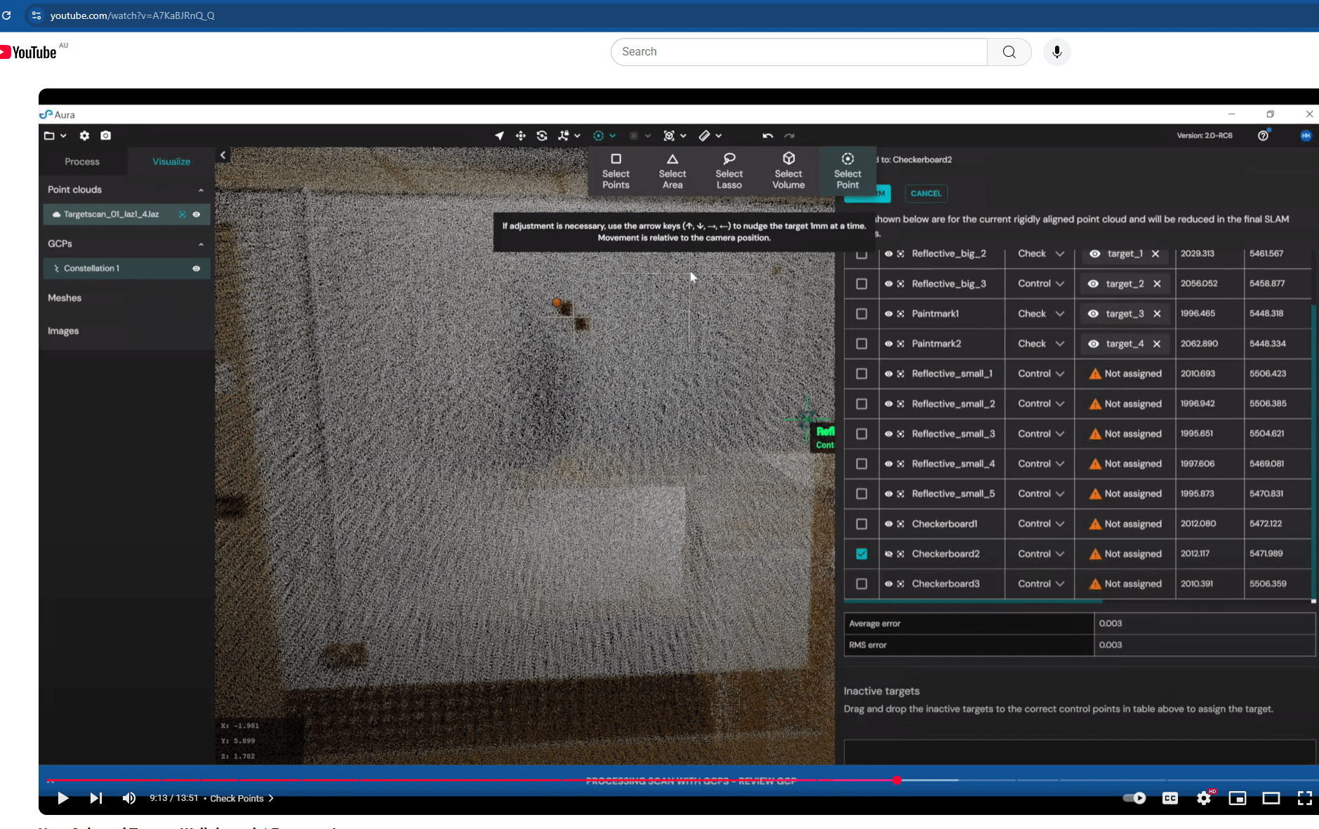
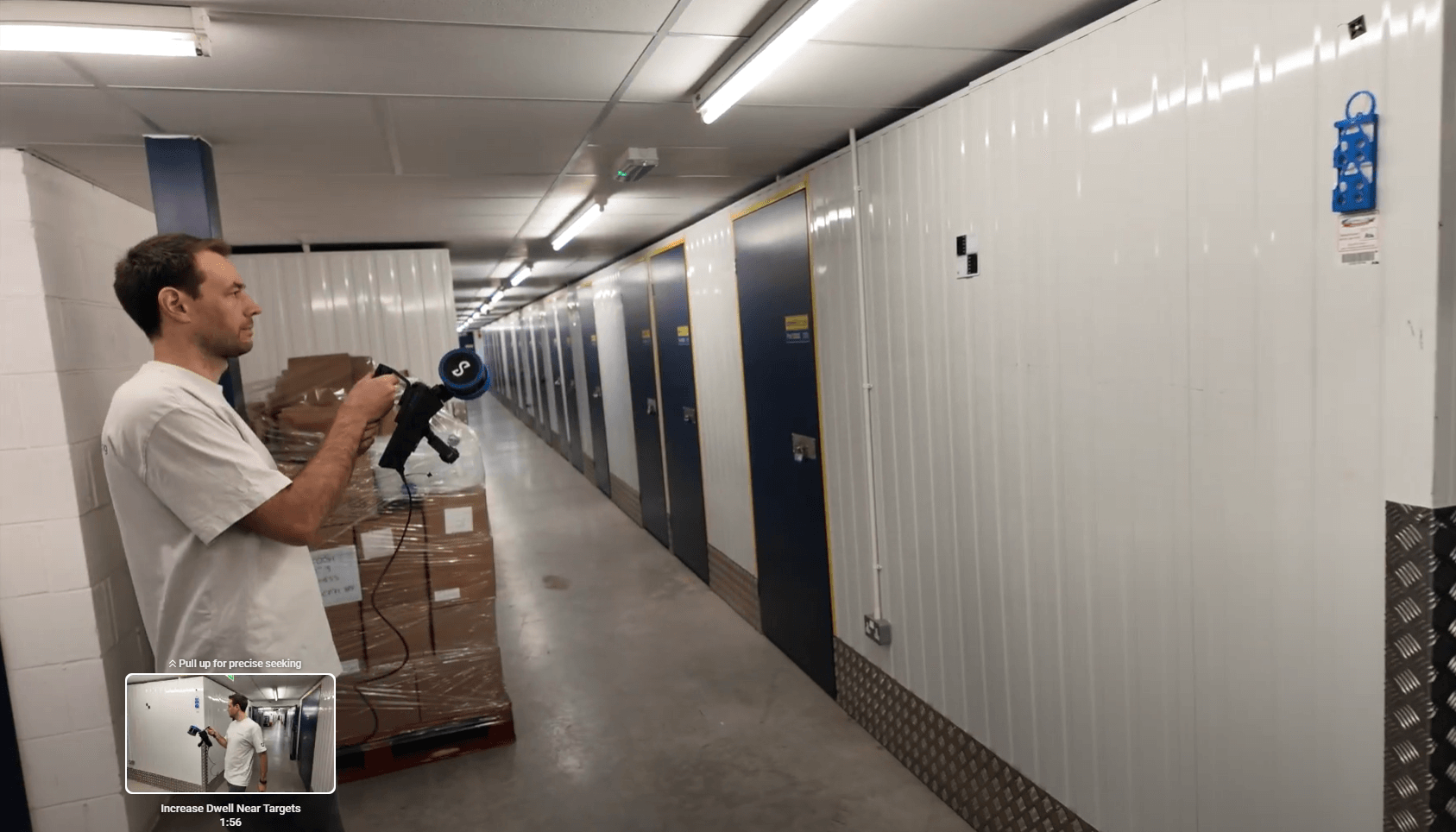
This dataset – from a Hovermap scan of a storage facility – demonstrates how user-selected targets were used in Aura 2.0 to georeference the scan and validate its real world accuracy.
A combination of reflective targets, paint marks, and checkerboard targets distributed throughout the site were used as control point and check points.
Control points reduce drift, align data to real-world coordinates, and improve scan accuracy, while check points provide independent accuracy validation.
Submit the form to download the dataset and view it for yourself.
Our how-to video will also show you the process in action and outline the recommended target selection and accuracy validation practices.
Download the dataset