Skip to content
Emesent
  • ProductsExpand
    • Payloads
      • Hovermap
      Software
      • Aura
      • Commander
      • Cortex
      Accessories
      • 360° Image Kit
      • Backpack RTK
      • CMS Mount
      • Drone RTK
      • Hovermap Cage
      • Hovermap LHD
      • Vehicle
 RTK
      Extensions
      • 360° Colorization
      • Automated Ground 
Control
      • Long Range Radio
      Robotics platforms
      • Boston Dynamics Spot robot
      • DJI M350 drone
      • Freefly Astro Max drone
      Ready to see how Emesent products work?​
      Get in touch
  • SolutionsExpand
    • Mining
      • Convergence Monitoring
      • Open Pit Mine Mapping
      • Stockpile Measurement
      • Stope Reconciliation
      • Underground Mine Production
      AEC
      • Construction As-built Survey
      • Infrastructure As-built Survey
      • Routine Bridge Inspection
      • Scan to BIM
      • Topographic Survey
      Industry use cases
      • AEC
      • Defense
      • Geospatial
      • Mining
      • Oil and Gas
      • Public Safety
      Third-party software workflows
      • For AEC
      • For Mining
      Ready to see how Emesent products work?​
      Get in touch
      Mining
      • Convergence Monitoring
      • Underground Mine Production
      AEC
      • Construction As-built Survey
      • Topographic Survey
      Industry use cases
      • AEC
      • Geospatial
      • Mining
      • Oil and Gas
      • Public Safety
      Ready to see how Emesent products work?​
      Get in touch
      Featured Case Study

      Leveraging 3D data for decision-making in public safety

      Read more
  • ResourcesExpand
      • ALL Resources
      • Blog
      • Case studies
      • Datasets
      • Events
      • News
      • Videos
      • Webinars
      • Client Portal
      • Emesent Assure
      • Knowledge Base
      • Partner Portal
      • Client Experience
      Ready to see how Emesent products work?​
      Get in touch
      Featured Content

      Hovermap Accuracy Report

      Read more

  • AboutExpand
      • Our Team
      • Careers
      • Contact
      Emesent’s strengths
      • Mapping
      • Autonomy
      • Versatility
      Ready to see how Emesent products work?​
      Get in touch
  • BuyExpand
      • Book a Demo
      • Explore Business Plans
      • Find a Reseller
      • Refer a Peer
      • Request Pricing
      • Shop Emesent Store
      Offers
      • Hovermap 100 offer
      • Autonomy discount
      Ready to see how Emesent products work?​
      Get in touch
Client Portal
Partner Portal
Account
Talk to a Specialist

Emesent
Customer Portal
Partner Portal

Author: Katie Koss

Into the dark unknown: How Hovermap is helping drive NASA’s future planetary ambitions
News

Into the dark unknown: How Hovermap is helping drive NASA’s future planetary ambitions

ByKatie Koss June 28, 2021October 7, 2024

NASA recently took one more giant leap for mankind after its Mars Helicopter, Ingenuity, made the first-ever test flight on another world.

Read More Into the dark unknown: How Hovermap is helping drive NASA’s future planetary ambitionsContinue

Improving Convergence Monitoring Using LiDAR Data at the Argyle Diamond Mine
Case Studies

Improving Convergence Monitoring Using LiDAR Data at the Argyle Diamond Mine

ByKatie Koss May 26, 2021October 10, 2024

Rio Tinto engaged MineLiDAR to trial Hovermap for convergence monitoring at its Argyle Diamond Mine, in Western Australia. Read the case study to learn how LiDAR performed.

Read More Improving Convergence Monitoring Using LiDAR Data at the Argyle Diamond MineContinue

Capturing Accurate Data from Airports, Subways & Warehouses
News

Capturing Accurate Data from Airports, Subways & Warehouses

ByKatie Koss May 17, 2021October 7, 2024

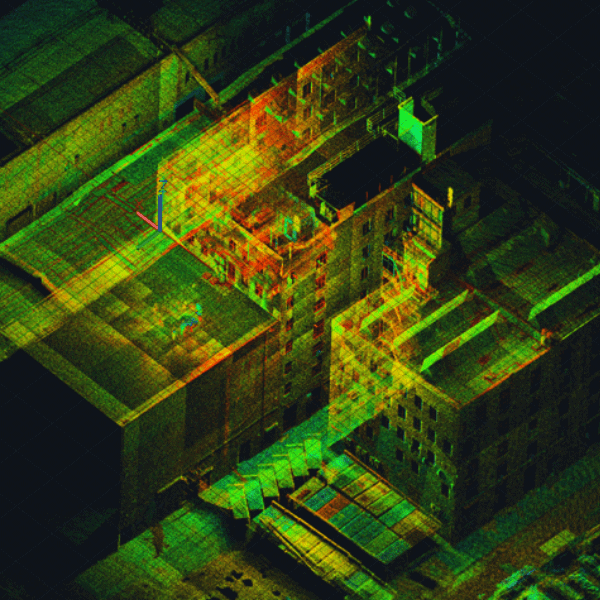
Qntfi Inc is a New York state based organization that is dedicated to helping companies extract meaningful information from raw data to enable them to make the right decisions.

Read More Capturing Accurate Data from Airports, Subways & WarehousesContinue

Better Data and Greater Insights for AEC
Webinars

Better Data and Greater Insights for AEC

ByKatie Koss May 17, 2021August 1, 2025

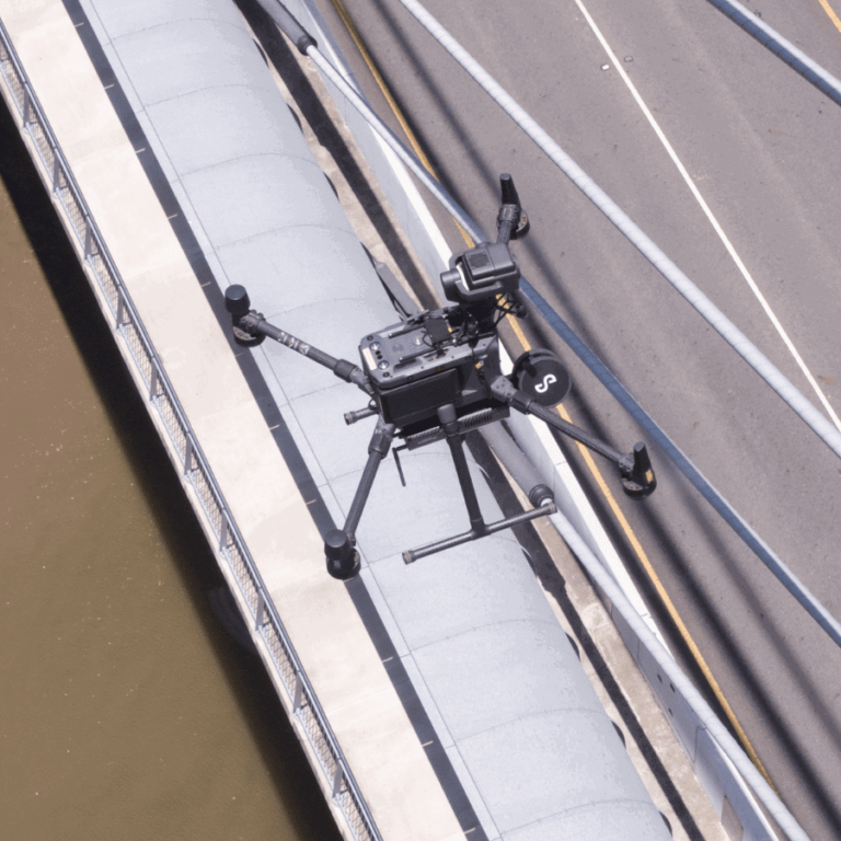
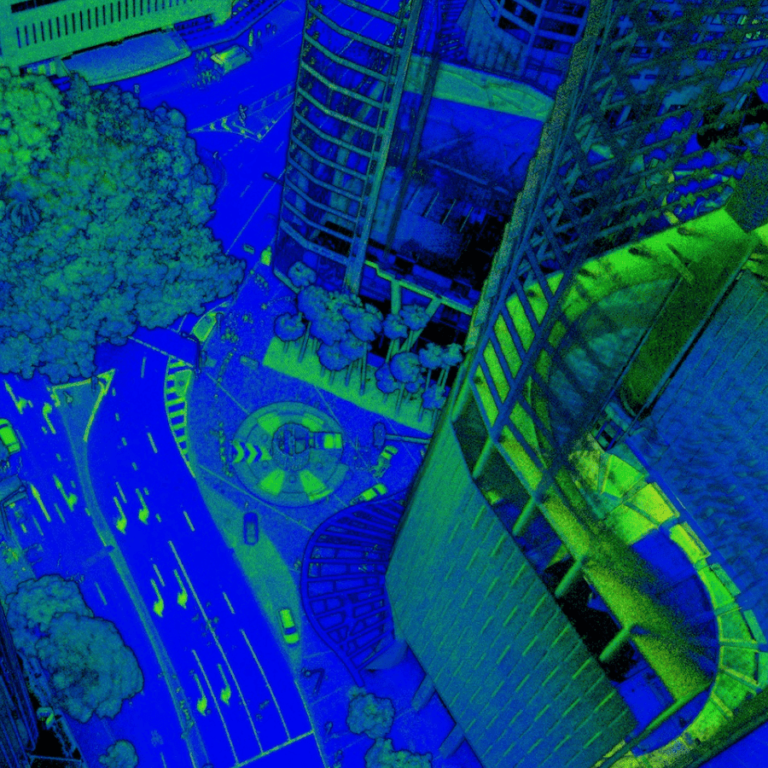
Hear from three data capture experts how they have improved their workflows for their construction and infrastructure projects.

Read More Better Data and Greater Insights for AECContinue

Building a more accurate BIM with Hovermap
Webinars

Building a more accurate BIM with Hovermap

ByKatie Koss May 17, 2021August 1, 2025

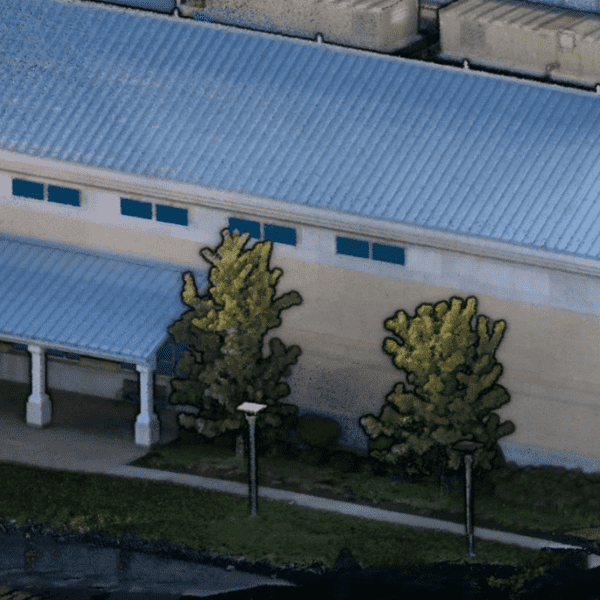
Hovermap customers talk about how they are able to reduce their time on site and capture high quality colorized point clouds for AEC bid jobs, facility management, floor plans, and other A&E projects.

Read More Building a more accurate BIM with HovermapContinue

Emesent and Datamine partnership
News

Emesent and Datamine partnership

ByKatie Koss May 10, 2021October 7, 2024

Emesent and Datamine have partnered to further assist mining companies to gain new insights from previously inaccessible areas, in a move that both CEO’s agree is a win-win for them and their customers.

Read More Emesent and Datamine partnershipContinue

Emesent Hovermap™ Demo Day
News

Emesent Hovermap™ Demo Day

ByKatie Koss March 5, 2021October 7, 2024

Join us for our upcoming Hovermap Demo Day where you can put Hovermap to the test.

Read More Emesent Hovermap™ Demo DayContinue

XM2 Pursuit Quickly Capture Hovermap LiDAR data for Blockbuster Special Effects
News

XM2 Pursuit Quickly Capture Hovermap LiDAR data for Blockbuster Special Effects

ByKatie Koss March 1, 2021October 7, 2024

Creating the visual effects (VFX) for a blockbuster, monster destroying the world film can take a significant amount of time.

Read More XM2 Pursuit Quickly Capture Hovermap LiDAR data for Blockbuster Special EffectsContinue

How Dwyka Mining Services is using Hovermap to scan and manage open cast voids
Case Studies

How Dwyka Mining Services is using Hovermap to scan and manage open cast voids

ByKatie Koss February 19, 2021October 10, 2024

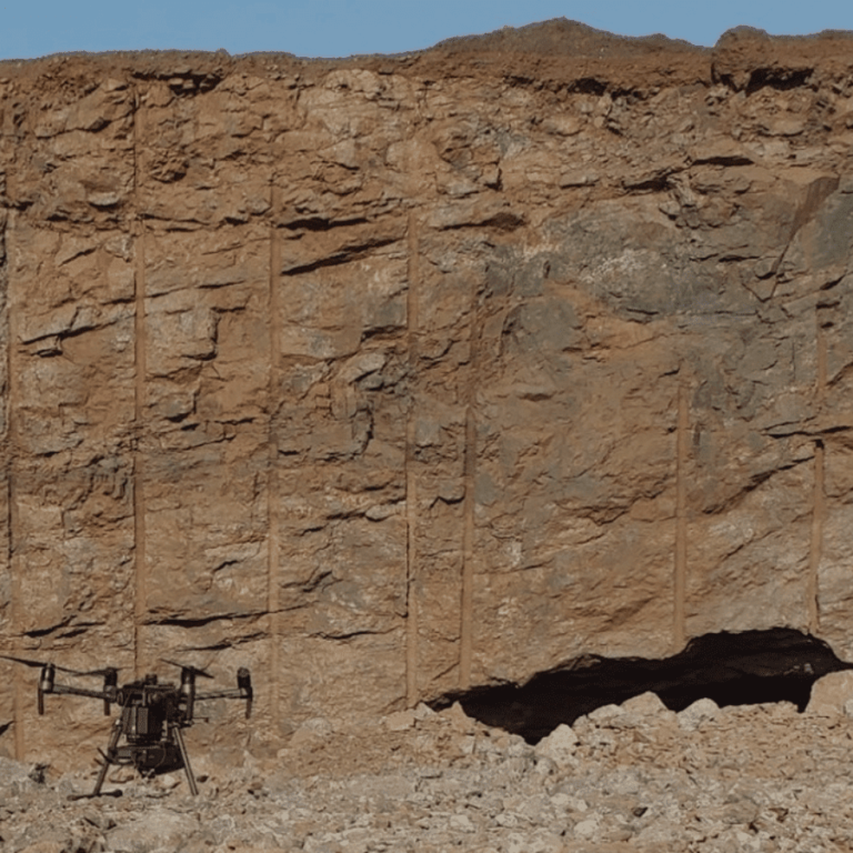
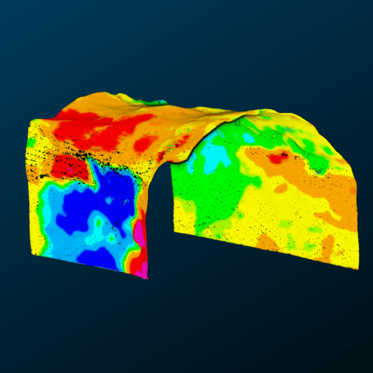
In November 2020, Emesent partner Dwyka Mining Services was contracted to assess the geometry and volume of a cavity that was exposed in a client’s open pit, following surface blasting.

Read More How Dwyka Mining Services is using Hovermap to scan and manage open cast voidsContinue

Improved stope design and reconciliation at Mungari Gold
Case Studies

Improved stope design and reconciliation at Mungari Gold

ByKatie Koss February 5, 2021November 6, 2024

How Emesent Hovermap technology helped Evolution Mining improve its stope design and reconciliation process at Mungari gold mine

Read More Improved stope design and reconciliation at Mungari GoldContinue

Page navigation

Previous PagePrevious 1 … 14 15 16 17 18 … 21 Next PageNext
Emesent provides actionable spatial intelligence within challenging and GPS-denied environments.
About our products
  • Hovermap
  • Aura
  • Commander
  • Book a Demo
  • Request Pricing
  • Business Plans
About our technology
  • Mapping
  • Autonomy
  • Versatility
Info & Resources
  • News & client stories
  • Client Portal
  • Where to buy
  • Partner Portal
  • Partner with us
  • Refer a peer
About our business
  • Contact us
  • About Emesent
  • Careers
  • Privacy Policy
  • Quality Policy

Copyright © 2026 Emesent. All rights reserved.

  • Products
    • Payloads
      • Hovermap
      Software
      • Aura
      • Commander
      • Cortex
      Accessories
      • 360° Image Kit
      • Backpack RTK
      • CMS Mount
      • Drone RTK
      • Hovermap Cage
      • Hovermap LHD
      • Vehicle
 RTK
      Extensions
      • 360° Colorization
      • Automated Ground 
Control
      • Long Range Radio
      Robotics platforms
      • Boston Dynamics Spot robot
      • DJI M350 drone
      • Freefly Astro Max drone
      Ready to see how Emesent products work?​
      Get in touch
  • Solutions
    • Mining
      • Convergence Monitoring
      • Open Pit Mine Mapping
      • Stockpile Measurement
      • Stope Reconciliation
      • Underground Mine Production
      AEC
      • Construction As-built Survey
      • Infrastructure As-built Survey
      • Routine Bridge Inspection
      • Scan to BIM
      • Topographic Survey
      Industry use cases
      • AEC
      • Defense
      • Geospatial
      • Mining
      • Oil and Gas
      • Public Safety
      Third-party software workflows
      • For AEC
      • For Mining
      Ready to see how Emesent products work?​
      Get in touch
      Mining
      • Convergence Monitoring
      • Underground Mine Production
      AEC
      • Construction As-built Survey
      • Topographic Survey
      Industry use cases
      • AEC
      • Geospatial
      • Mining
      • Oil and Gas
      • Public Safety
      Ready to see how Emesent products work?​
      Get in touch
      Featured Case Study

      Leveraging 3D data for decision-making in public safety

      Read more
  • Resources
      • ALL Resources
      • Blog
      • Case studies
      • Datasets
      • Events
      • News
      • Videos
      • Webinars
      • Client Portal
      • Emesent Assure
      • Knowledge Base
      • Partner Portal
      • Client Experience
      Ready to see how Emesent products work?​
      Get in touch
      Featured Content

      Hovermap Accuracy Report

      Read more

  • About
      • Our Team
      • Careers
      • Contact
      Emesent’s strengths
      • Mapping
      • Autonomy
      • Versatility
      Ready to see how Emesent products work?​
      Get in touch
  • Buy
      • Book a Demo
      • Explore Business Plans
      • Find a Reseller
      • Refer a Peer
      • Request Pricing
      • Shop Emesent Store
      Offers
      • Hovermap 100 offer
      • Autonomy discount
      Ready to see how Emesent products work?​
      Get in touch
  • Customer Portal
  • Partner Portal

  • العربية‏
  • Español
  • 日本語
  • Português
  • 中文 (简体)

Book a Demo
Search