
Announcing the release of Cortex 4.0 and Commander 2.1 software
Emesent, a global leader in autonomous digital mapping, has passed a major capability milestone with the most significant upgrade yet of its autonomous mapping technology.
In its early years, Emesent’s award-winning SLAM-based LiDAR scanner Hovermap gained traction among mining clients needing a solution that safely supplied crucial situational data to allow site managers to identify operational risks in dangerous, GPS-denied environments.
Autonomous drones driven by Hovermap’s Cortex software enabled operators to rapidly survey inaccessible or restricted environments – such as stopes, ore passes, headings and old workings – for actionable detail.
Building on these capabilities, Cortex 4.0 offers fully autonomous navigation and exploration to allow mapping of previously inaccessible areas in even the most challenging conditions.
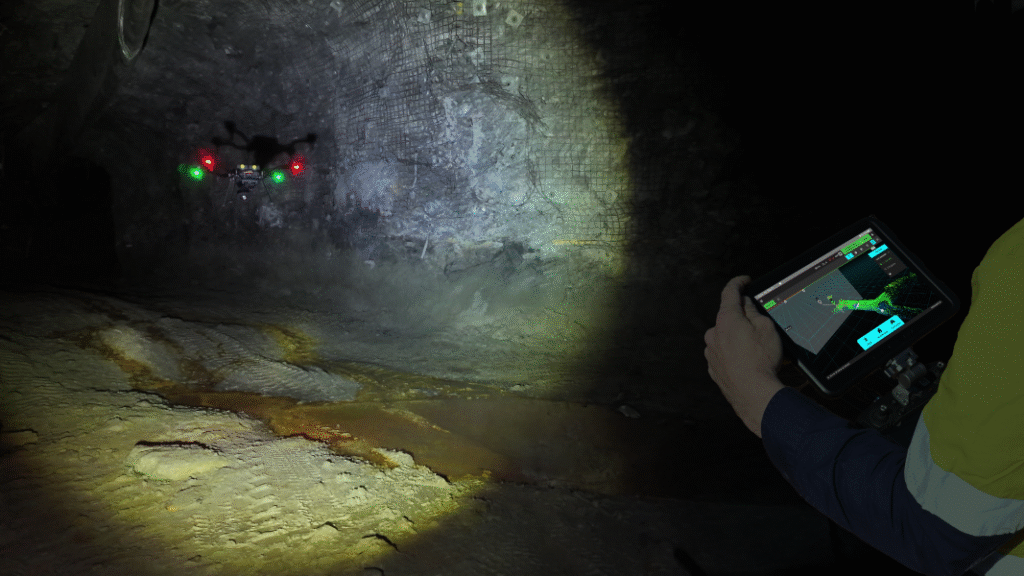
Traditional mapping methodologies – such as boom-mounted CMS – increase the risk to personnel by putting them in harm’s way. Emesent’s solution transforms the workflow by allowing surveyors to build an accurate picture of an unknown target area that’s beyond line of sight and communications range.
To achieve this, Emesent has enhanced how Hovermap tackles inaccessible environments.
“We’re giving operators more confidence by enabling Hovermap to fly autonomously through even narrower spaces,” said Dr Hrabar. “Improvements in Hovermap’s perception technology allow drones to pass through gaps as small as 2.4 meters without human intervention.”
Emesent has also accelerated time to action for decisions based on captured Hovermap data, with the ability to create point clouds onboard Hovermap after a mission, and view them in detail in the Commander app.
“With our new onboard processing, we’ve improved the speed at which decisions can be made in the field by allowing operators to see captured data immediately after the mission is complete.” said Dr Hrabar. “No more waiting to get back to base to process and visualize the data.”
More information about fully autonomous exploration and mapping can be found in this recorded product briefing. To learn more about Hovermap, Cortex, Commander, Aura, Hovermap accessories and Emesent industry solutions visit the Emesent website.
Existing users of Emesent’s Autonomy subscription have immediate access to the new capabilities, without any changes to their licensing. Emesent Cortex version 4.0 and Commander version 2.1 are now available for existing clients via the Client Portal on the Emesent website.
For a demonstration of all Emesent products please book a demo.
For media related questions please select Contact the Marketing Team when you submit an enquiry.