Skip to content
Emesent
  • ProductsExpand
    • Payloads
      • Hovermap
      Software
      • Aura
      • Commander
      • Cortex
      Accessories
      • 360° Image Kit
      • Backpack RTK
      • CMS Mount
      • Drone RTK
      • Hovermap Cage
      • Hovermap LHD
      • Vehicle
 RTK
      Extensions
      • 360° Colorization
      • Automated Ground 
Control
      • Long Range Radio
      Robotics platforms
      • Boston Dynamics Spot robot
      • DJI M350 drone
      • Freefly Astro Max drone
      Ready to see how Emesent products work?​
      Get in touch
  • SolutionsExpand
    • Mining
      • Convergence Monitoring
      • Open Pit Mine Mapping
      • Stockpile Measurement
      • Stope Reconciliation
      • Underground Mine Production
      AEC
      • Construction As-built Survey
      • Infrastructure As-built Survey
      • Routine Bridge Inspection
      • Scan to BIM
      • Topographic Survey
      Industry use cases
      • AEC
      • Defense
      • Geospatial
      • Mining
      • Oil and Gas
      • Public Safety
      Third-party software workflows
      • For AEC
      • For Mining
      Ready to see how Emesent products work?​
      Get in touch
      Mining
      • Convergence Monitoring
      • Underground Mine Production
      AEC
      • Construction As-built Survey
      • Topographic Survey
      Industry use cases
      • AEC
      • Geospatial
      • Mining
      • Oil and Gas
      • Public Safety
      Ready to see how Emesent products work?​
      Get in touch
      Featured Case Study

      Leveraging 3D data for decision-making in public safety

      Read more
  • ResourcesExpand
      • ALL Resources
      • Blog
      • Case studies
      • Datasets
      • Events
      • News
      • Videos
      • Webinars
      • Client Portal
      • Emesent Assure
      • Knowledge Base
      • Partner Portal
      • Client Experience
      Ready to see how Emesent products work?​
      Get in touch
      Featured Content

      Hovermap Accuracy Report

      Read more

  • AboutExpand
      • Our Team
      • Careers
      • Contact
      Emesent’s strengths
      • Mapping
      • Autonomy
      • Versatility
      Ready to see how Emesent products work?​
      Get in touch
  • BuyExpand
      • Book a Demo
      • Explore Business Plans
      • Find a Reseller
      • Refer a Peer
      • Request Pricing
      • Shop Emesent Store
      Offers
      • Hovermap 100 offer
      • Autonomy discount
      Ready to see how Emesent products work?​
      Get in touch
Client Portal
Partner Portal
Account
Talk to a Specialist

Emesent
Customer Portal
Partner Portal

Emesent takes part in Navy’s Autonomous Warrior 2020
News

Emesent takes part in Navy’s Autonomous Warrior 2020

ByKatie Koss December 10, 2020October 7, 2024

Even though the Royal Australian Navy is over a century old they are pushing boundaries, constantly looking for better and innovative ways to keep Australians safe.

Read More Emesent takes part in Navy’s Autonomous Warrior 2020Continue

Hovermap wins Innovative Mining Solution Award
News

Hovermap wins Innovative Mining Solution Award

ByKatie Koss December 9, 2020October 7, 2024

We’re proud to have been announced the winner of the Innovative Mining Solution award in the 2020 Prospect Awards. The awards are held by Australian Mining and recognize Australia’s outstanding mining and minerals processing achievements.

Read More Hovermap wins Innovative Mining Solution AwardContinue

How Digital Terrain is Putting Emesent’s Hovermap to Work
News

How Digital Terrain is Putting Emesent’s Hovermap to Work

ByKatie Koss December 1, 2020October 7, 2024

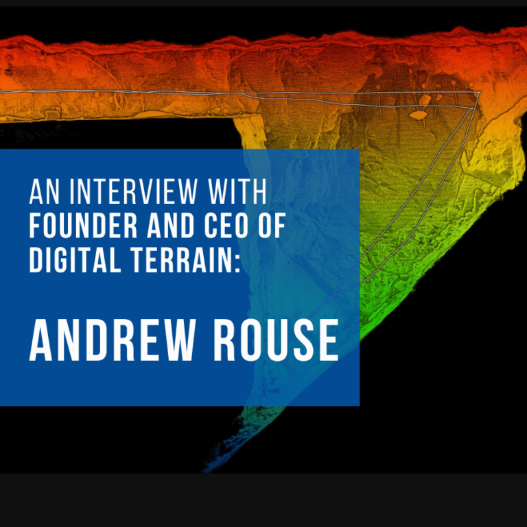
Mining information systems specialist Andrew Rouse is the founder and CEO of Digital Terrain, an IT mining services provider that improves the productivity and efficiency of underground mines through digitisation and IoT technologies.

Read More How Digital Terrain is Putting Emesent’s Hovermap to WorkContinue

Using Hovermap data in Deswik.AdvSurvey
Webinars

Using Hovermap data in Deswik.AdvSurvey

ByKatie Koss November 26, 2020October 7, 2024

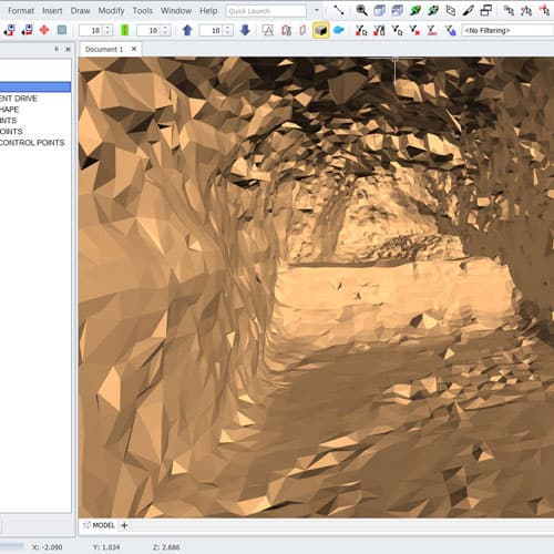
In July 2020, we partnered with Deswik to help mining companies incorporate the high-quality data captured with Hovermap into their mine plans and surveys.

Read More Using Hovermap data in Deswik.AdvSurveyContinue

Hovermap Redwood Tree scan
Videos

Hovermap Redwood Tree scan

ByKatie Koss November 19, 2020October 10, 2024

Read More Hovermap Redwood Tree scanContinue

Interpine are speeding up forest imagery plotting with Hovermap
News

Interpine are speeding up forest imagery plotting with Hovermap

ByKatie Koss November 18, 2020October 7, 2024

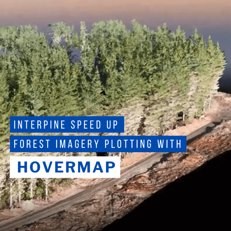
Hovermap datasets combine with Interpine’s customized deep learning algorithms for fast and accurate quantitative tree assessment.

Read More Interpine are speeding up forest imagery plotting with HovermapContinue

LKAB Kiruna Seismic Event Inspections
Case Studies

LKAB Kiruna Seismic Event Inspections

ByKatie Koss October 30, 2020February 6, 2025

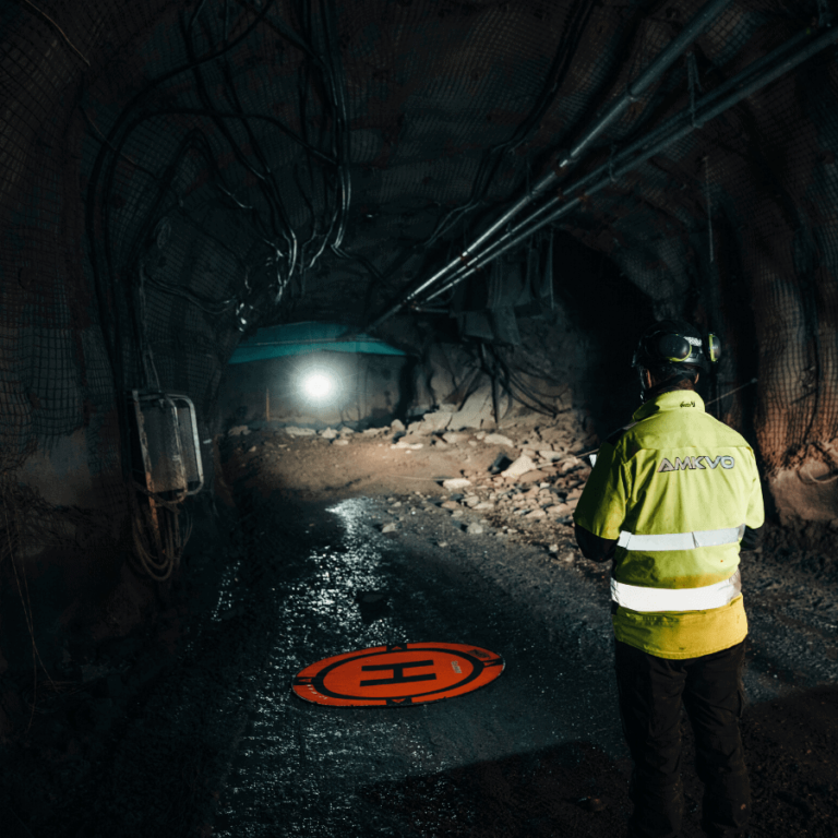
Emesent Hovermap technology helps LKAB complete fall of ground inspections quickly and safely at Kiruna mine.

Read More LKAB Kiruna Seismic Event InspectionsContinue

Pertamina Balongan Refinery Data Capture
Case Studies

Pertamina Balongan Refinery Data Capture

ByKatie Koss October 30, 2020October 10, 2024

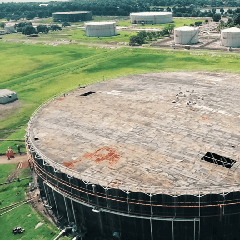
Emesent Hovermap technology helps Pertamina safely survey a bulk oil storage tank at the Balongan refinery.

Read More Pertamina Balongan Refinery Data CaptureContinue

Stope Mapping with Hovermap
Blog

Stope Mapping with Hovermap

ByKatie Koss October 29, 2020October 15, 2024

Hovermap enables data capture of critical underground mine excavations, delivering new insights for mine planning and operations.

Read More Stope Mapping with HovermapContinue

Emesent two years on: From start-up to global business
News

Emesent two years on: From start-up to global business

ByKatie Koss October 26, 2020July 9, 2025

Beginning life as a CSIRO project, Emesent has now grown into a fully-fledged commercial enterprise that turned two this week!

Read More Emesent two years on: From start-up to global businessContinue

Page navigation

Previous PagePrevious 1 … 24 25 26 27 28 29 Next PageNext
Emesent provides actionable spatial intelligence within challenging and GPS-denied environments.
About our products
  • Hovermap
  • Aura
  • Commander
  • Book a Demo
  • Request Pricing
  • Business Plans
About our technology
  • Mapping
  • Autonomy
  • Versatility
Info & Resources
  • News & client stories
  • Client Portal
  • Where to buy
  • Partner Portal
  • Partner with us
  • Refer a peer
About our business
  • Contact us
  • About Emesent
  • Careers
  • Privacy Policy
  • Quality Policy

Copyright © 2025 Emesent. All rights reserved.

  • Products
    • Payloads
      • Hovermap
      Software
      • Aura
      • Commander
      • Cortex
      Accessories
      • 360° Image Kit
      • Backpack RTK
      • CMS Mount
      • Drone RTK
      • Hovermap Cage
      • Hovermap LHD
      • Vehicle
 RTK
      Extensions
      • 360° Colorization
      • Automated Ground 
Control
      • Long Range Radio
      Robotics platforms
      • Boston Dynamics Spot robot
      • DJI M350 drone
      • Freefly Astro Max drone
      Ready to see how Emesent products work?​
      Get in touch
  • Solutions
    • Mining
      • Convergence Monitoring
      • Open Pit Mine Mapping
      • Stockpile Measurement
      • Stope Reconciliation
      • Underground Mine Production
      AEC
      • Construction As-built Survey
      • Infrastructure As-built Survey
      • Routine Bridge Inspection
      • Scan to BIM
      • Topographic Survey
      Industry use cases
      • AEC
      • Defense
      • Geospatial
      • Mining
      • Oil and Gas
      • Public Safety
      Third-party software workflows
      • For AEC
      • For Mining
      Ready to see how Emesent products work?​
      Get in touch
      Mining
      • Convergence Monitoring
      • Underground Mine Production
      AEC
      • Construction As-built Survey
      • Topographic Survey
      Industry use cases
      • AEC
      • Geospatial
      • Mining
      • Oil and Gas
      • Public Safety
      Ready to see how Emesent products work?​
      Get in touch
      Featured Case Study

      Leveraging 3D data for decision-making in public safety

      Read more
  • Resources
      • ALL Resources
      • Blog
      • Case studies
      • Datasets
      • Events
      • News
      • Videos
      • Webinars
      • Client Portal
      • Emesent Assure
      • Knowledge Base
      • Partner Portal
      • Client Experience
      Ready to see how Emesent products work?​
      Get in touch
      Featured Content

      Hovermap Accuracy Report

      Read more

  • About
      • Our Team
      • Careers
      • Contact
      Emesent’s strengths
      • Mapping
      • Autonomy
      • Versatility
      Ready to see how Emesent products work?​
      Get in touch
  • Buy
      • Book a Demo
      • Explore Business Plans
      • Find a Reseller
      • Refer a Peer
      • Request Pricing
      • Shop Emesent Store
      Offers
      • Hovermap 100 offer
      • Autonomy discount
      Ready to see how Emesent products work?​
      Get in touch
  • Customer Portal
  • Partner Portal

  • العربية‏
  • Español
  • 日本語
  • Português
  • 中文 (简体)

Book a Demo
Search