Unlock the Power of Precision Mapping: Emesent Hovermap Backpack RTK
Join us for an exclusive deep dive into the revolutionary Emesent Hovermap RTK Backpack—a game-changing tool for high-accuracy LiDAR mapping.

Join us for an exclusive deep dive into the revolutionary Emesent Hovermap RTK Backpack—a game-changing tool for high-accuracy LiDAR mapping.

The Department of Special Geodesy at the Czech Technical University in Prague put Emesent Hovermap to the test in a 120 meter long mining tunnel. How did it fare against other scanners, both static and SLAM-based?

Join Emesent partner Dwyka Mining Services and Dwarsrivier Mine as they reveal how Hovermap’s handheld and backpack devices provided precise, real-time data for month-end measurements, plan updates, stockpile tracking, and room and pillar design, boosting productivity and improving decision-making.

This scan of a 500m x 500m open pit mine was captured in just 9 minutes by Emesent Hovermap mounted to a drone. Being able to see the shells of the pit in reality, rather than just from design, helps life-of-mine planning departments when comparing the plan to as-built. The scan was colorized using the…
Join Emesent partner Gestao Engenharia as they explore the methodology behind monitoring convergence of the access gallery at a gold mine.

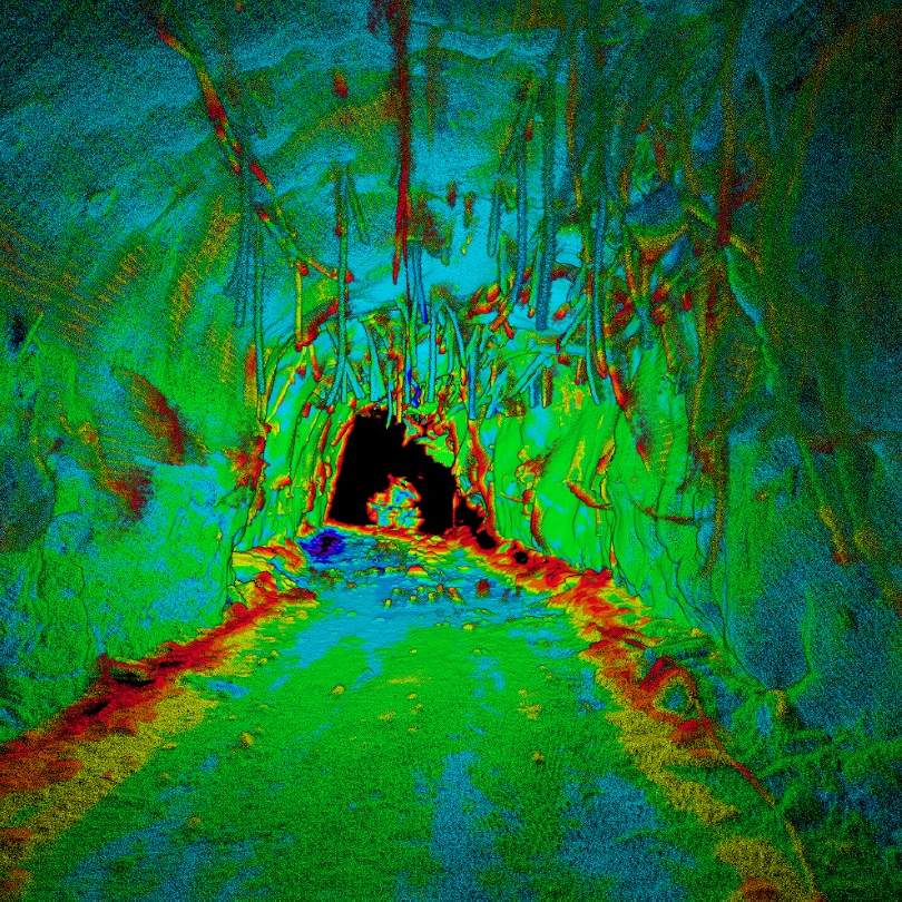
Download the dataset produced during Emesent’s Backpack RTK accuracy test. Conducted along a 950m stretch of road in Brisbane, Australia, and verified by Orion Spatial Solutions.

Download the dataset produced during Emesent’s Vehicle RTK accuracy test. Conducted along a 2km stretch of road in Brisbane, Australia, and verified by Orion Spatial Solutions.

Join Emesent Co-founder and Chief Strategy Officer Dr Stefan Hrabar, as he does a deep dive into what makes Emesent Hovermap so accurate compared to other SLAM-based scanners.

See best practice in action as Emesent’s Henry Henderson-Genefaas walks through the capture and processing of real-world data using automated ground control points. With clear step-by-step instructions and some troubleshooting tips, this video answers some of our most frequently asked GCP questions.

Emesent, developer of autonomous SLAM-based mobile surveying solution Hovermap, has expanded its board, inviting mining industry executive Christofer Catania to join.